UDOT PLANNED AVALANCHE CLOSURES!!

Observation: Chicken Sh#! Ridge

Observation Date
11/28/2018
Observer Name
Mark Staples and Trent Meisenheimer
Region
Salt Lake » Big Cottonwood Canyon » Days Fork » Chicken Sh#! Ridge
Location Name or Route
Days Fk Chicken Sh#! Ridge
Red Flags
Red Flags
Collapsing
Red Flags Comments
I was a bit surprised how many collapses we experienced today on E and ESE aspects. Maybe two dozen collapses between 8k and 10k. They were not "rolling thunder" type collapses but were about 20-50 feet across. Regardless, getting this many collapses told me all I need to know - getting on a steeper slope would have meant an avalanche and conditions remain unstable.
Avalanche Problem #1
Problem
Persistent Weak Layer
Problem #1 Comments
The main issue is weak faceted snow that fell in October. We wanted to map the existence of this layer on E and SE facing slopes at elevations from 8k to 10k.
  • It exists on E aspects at mid and upper elevations
  • On SE aspects it generally does not exist until you get above 9500 feet but can be found in spots.
  • There are many more facets on ESE and less soon SE.
Comments
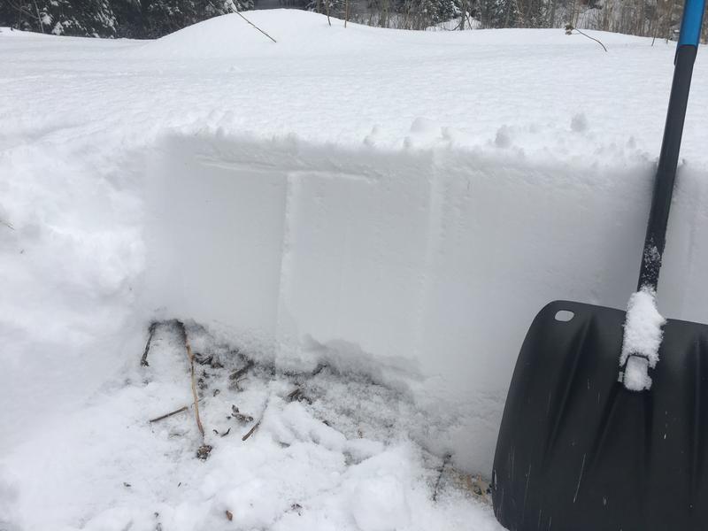
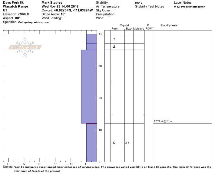
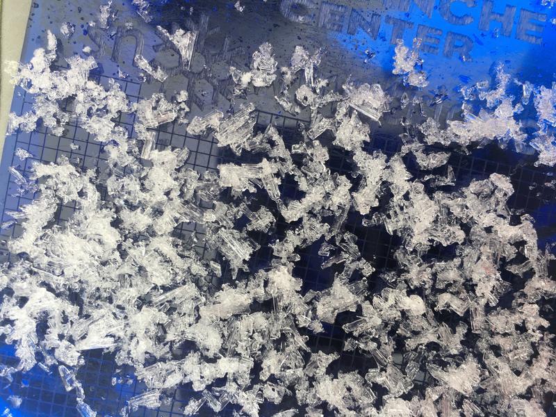
Photo and snow profile below from pit at 8k and east facing.
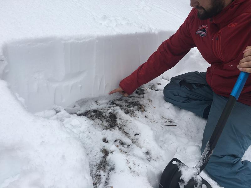
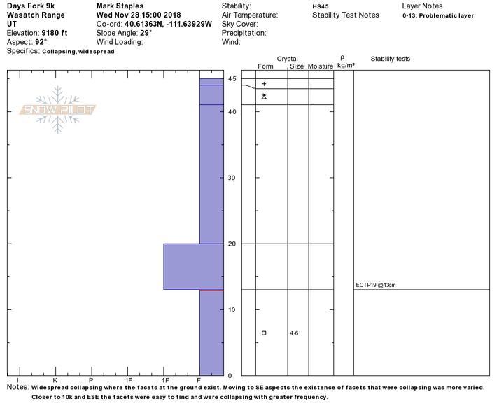
Photo and snow profile below from 9k and East facing. Also included is a photo of the 4-6 mm facets at the ground.
Video
Today's Observed Danger Rating
Considerable
Tomorrows Estimated Danger Rating
Considerable
Coordinates