
Observation Date
11/24/2018
Observer Name
Greg Gagne
Region
Salt Lake » Little Cottonwood Canyon » Catherine's Pass
Location Name or Route
Catherine's Pass Area/Rocky Point
Comments
Very intense, sustained winds blowing above 9000' made for dangerous avalanche conditions today, particularly on slopes with weak faceted snow underneath. The dense, wind-blown snow was quite supportable (ski pens were 5-10 cms) and my concern is this new slab will gain strength, and make those slopes with persistent snow at the base "feel" stable. (But in reality it now will just be harder to trigger avalanches, and that any avalanches will just now be larger.)
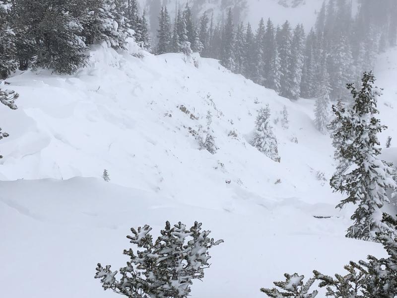
Photo below is from Rocky Point, an apparent natural avalanche that connected across ~250'. Mark White had reported slides on this slope on Thanksgiving, and this slope was re-loaded with storm and wind-blown snow. It failed on a layer of facets sitting above the October crust. I submitted this under a separate avalanche observation. Take home for me was that slopes with persistent weaknesses that have avalanched have just re-loaded and are primed for more avalanching.
Video
Although I did not ride south-facing slopes, I did talk to a few parties that were on the south aspects around Michigan City in Grizzly Gulch and they reported the storm snow is supportable and is covering up many of the rocks. With continued danger due to weak facets on slopes facing west through southeast, we may have options for much safer riding on south and southwest aspects.
Today's Observed Danger Rating
High
Tomorrows Estimated Danger Rating
High


