Observation: Rocky Point

Observation Date
11/21/2018
Observer Name
Evelyn
Region
Salt Lake » Big Cottonwood Canyon » Rocky Point
Location Name or Route
Alta summer road to Rocky Point
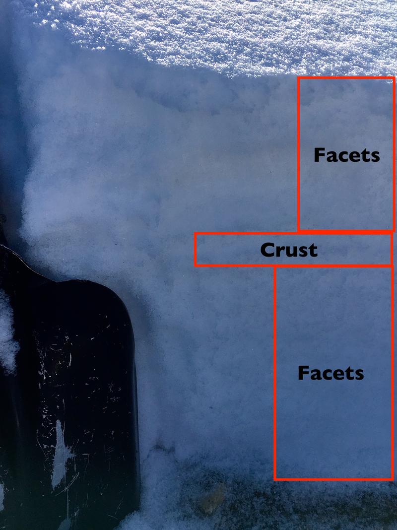
Weather
Sky
Clear
Wind Speed
Calm
Weather Comments
High thin clouds increasing in the afternoon.
Snow Characteristics
Snow Surface Conditions
Faceted Loose
Snow Characteristics Comments
Weak, sugary facets from top to bottom, with a weakening mid pack crust in places.
Photo by Jack Dawe. Thanks!
Red Flags
Red Flags
Poor Snowpack Structure
Red Flags Comments
It is a super weak snowpack. Surface facets are to the point of sluffing on steep slopes. In addition, there are more large, weak facets on the ground. The weak snow will not be able to hold much of a new load of snow. Depending on snow and wind, avalanche danger could be Moderate or Considerable tomorrow.
Avalanche Problem #1
Problem
Persistent Weak Layer
Trend
Increasing Danger
Problem #1 Comments
Persistent weak layers, or faceted snow, is a dangerous weak layer once it gets loaded. At the moment, almost all the snow you see out there in the mountains is faceted. These will be the slopes to avoid once it snows again.
Avalanches failing on persistent weak layers can be triggered on a steep slope, or from slopes connected to a steep slope - such as from the side or from below. Arrows below show examples of low angle terrain that is below and connected to steeper slopes. Once we get a load of new snow, avalanches can be triggered from below and travel below steep slopes should be avoided.
Snow Profile
Aspect
North
Elevation
10,200'
Slope Angle
35°
Comments
Same north facing slope at 10, 350'.
Today's Observed Danger Rating
Low
Tomorrows Estimated Danger Rating
Moderate
Coordinates