Get Your Ticket to the 32nd Annual Backcountry Benefit on September 11th! Support Forecasting, Awareness, and Education

Observation Date
11/19/2018
Observer Name
Grainger
Region
Salt Lake
Location Name or Route
Lake Catherine Basin
Weather
Sky
Clear
Snow Characteristics
Snow Surface Conditions
Faceted Loose
Melt-Freeze Crust
Snow Characteristics Comments
Traveled through Catherine's Pass, Pt. Supreme, over Sunset Peak, through Lake Catherine Basin. Snowpack seemed to be maintaining its facet and crust layering above 9000' on NNW--E aspects. Other elevations and aspects had minimal and inconsistent snow on the ground. Looking to compare with Mark S./Mark W. obs. from one week ago, we dug into an ENE aspect of the Basin at 10,200'. 42 cm snowpack at this location.
With the intent of finding what this weekend's probable storm will fall on, this more Easterly aspect provided basal facets, a 6cm pencil crust, smaller-grain facets, then the 11/17 1" of newer snow on top.
The basal facets are weak and ~1mm. These under the crust are concerning but a PST showed SF 29/100 and multiple ECTX gave me some hope for less pronounced propagation once a load falls on top. With the high pressure still in play for the week, I would guess this shallow structure will continue to weaken.
Red Flags
Red Flags
Poor Snowpack Structure
Comments
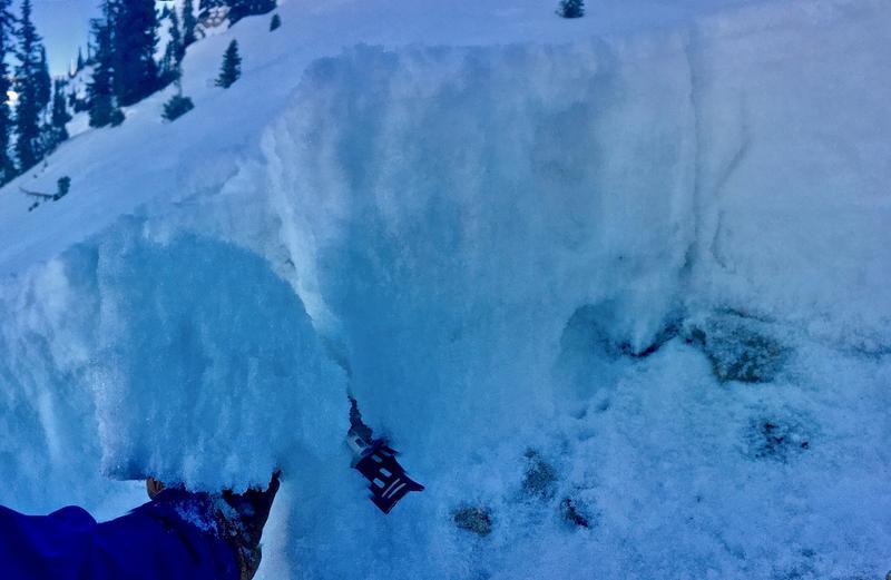
42cm snowpack. From the ground: weak basal facets, a pencil-hard 6cm crust, weak smaller-grain facets, 1"snow from 11/17.
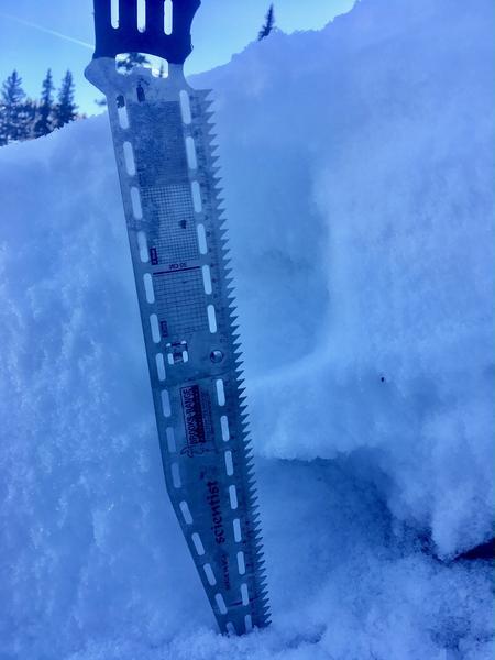
PST underneath the crust provided a SF 29/100. In this location weaker crust than I'd thought.
Forecaster edit.
Today's Observed Danger Rating
None
Tomorrows Estimated Danger Rating
None
Coordinates