Observation: Flagstaff Ridge

Observation Date
11/18/2018
Observer Name
Evelyn
Region
Salt Lake » Little Cottonwood Canyon » Flagstaff Ridge
Location Name or Route
Flagstaff from Alta
Weather
Sky
Clear
Wind Speed
Calm
Weather Comments
Clear skies before noon, with some high thin clouds in the afternoon.
Snow Characteristics
New Snow Depth
2"
New Snow Density
Low
Snow Surface Conditions
Powder
Snow Characteristics Comments
Classic day of not being able to do what I was hoping to. Reaching the top of the ridge line, the upper northerly slopes had been wind scored down to the October rain crust, with just the most recent inch or two of Saturday snow on top. The crust there was still quite strong - very hard and icy, creating slide for life conditions and not favorable for working down slope to a deeper snowpack. Good views of snow coverage though.
Red Flags
Red Flags
Poor Snowpack Structure
Avalanche Problem #1
Problem
Persistent Weak Layer
Problem #1 Comments
Weak, faceted snow and a buried crust are the common theme on the shady, northerly facing slopes at mid and upper elevations. To simplify, I'm dividing the facets into 2 main layers - facets above the October rain crust and facets below it. (There are lots of variations on this theme - including slopes with a second, weak crust higher in the snowpack or places where all the crusts are weakening and disappearing). With the first snow or just a smaller storm, I'd expect sluffing and soft slabs failing right at the new snow/old snow interface or above the crust. Slides will be able to run on the slick crust, entraining snow as they move down slope, creating larger slides. The facets below the crust are much larger and weaker, but it's going to take a bigger storm and more snow weight to break through the crust. Collapsing and whoomphing will become an important clues. Slides failing below the crust will be basically going to the ground. In both cases, the presence of a crust instead of just facets will allow slides to be wider and connect across more terrain.
Comments
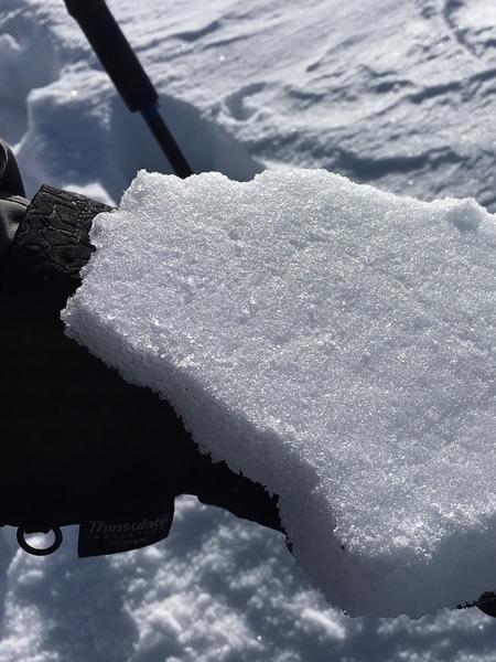
Photos below - upper is the hard, slick October rain crust that hasn't weakened much in this location. Super slick, potential for "slide for life" along these ridge lines. 
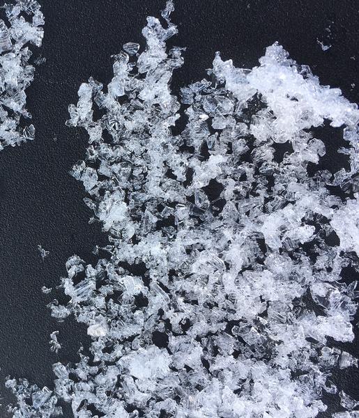
Lower photo: well developed facets from near the ground, below the October rain crust. Super weak and loose, with plenty of sharp angles and striations that you can see with the naked eye.,
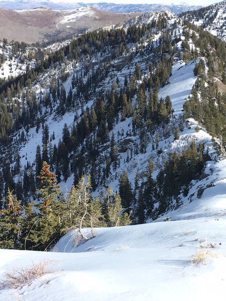
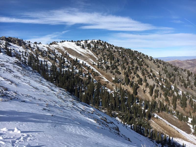
Below: three photos looking into upper Days Fork. First is lookiing toward the east, slopes have complete coverage top to bottom. Second is looking west, again slopes are filled in until the bowl starts to turn more easterly and then southerly, which is the third photo, looking at the top of Main Days, peak 10,561.
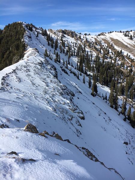
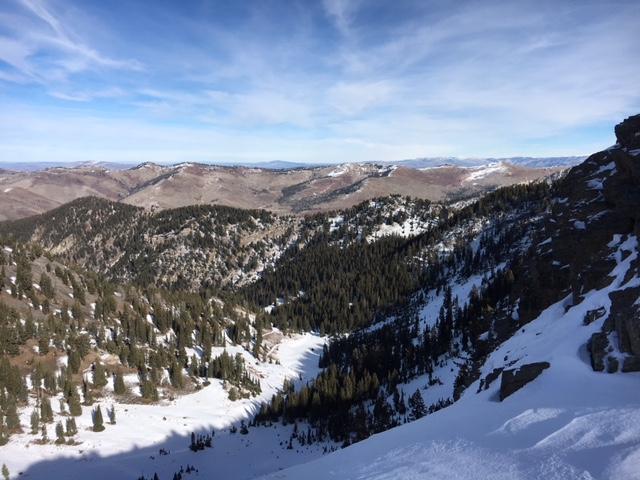
And the final photo - looking toward the Big Cottonwood/Park City ridge line. Sure "dry and brown" isn't what we really want, but it's actually good news - there will be lots of terrain, especially south facing, with no facets once we get some snow.
Today's Observed Danger Rating
Low
Tomorrows Estimated Danger Rating
Low