Observation Date
11/17/2018
Observer Name
Greg Gagne
Region
Salt Lake » Park City Ridgeline » Monitors
Location Name or Route
Park City Ridgeline - Monitors
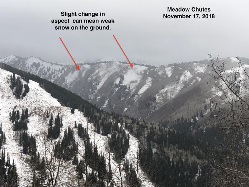
Trail run (sans skis) from Solitude up through the Willows along Park City ridgeline to the monitors. Snow depths above 9500' range from 10-30 cms (4-12")with widespread weak snow. Went into top of West Monitor starting zone where there is about 20-25 cms (8-10") total snow with a dense melt-freeze crust at the ground and 5-10 cms (2-4") ofweak, faceted snow on top. Poor visibiity, but from what I could see along the PC ridgeline, most starting zones have weak snow, and only those that face south enough have little snow. The tricky thing is that with the low sun angle, a slight change in aspect can mean you quickly move from a slope with little or no pre-existing weak snow to one that has all weak snow.
Photo is looking towards the Meadow Chutes demonstrating how a change in aspect can have a big difference with weak, pre-existing snow.
Video below is from West Monitor on Park City ridgeline showing existing snowpack.
Video
Today's Observed Danger Rating
None
Tomorrows Estimated Danger Rating
None


