Observation: Salt Lake

Observation Date
10/15/2018
Observer Name
B
Region
Salt Lake
Location Name or Route
Brighton to Sunset/Catherines Pass
Red Flags
Red Flags
Wind Loading
Poor Snowpack Structure
Avalanche Problem #1
Problem
Wind Drifted Snow
Trend
Decreasing Danger
Problem #1 Comments
NNW Moderate winds above 10200 feet with Moderate Transport and or Wind Blown. Active loading on windward slopes as well as crossloading in exposed upper elevation terrain. Did not find any new wind slabs of note in area traveled, yet plums off the peaks indicated potential. Of note, old lingering wind slabs from 1cm to 10 cm thick were observed and these wind slabs appeared to have formed on Friday, 10/12 the day after the significant snow event. At this point these are stubborn and unreactive on 35 degree slopes.
Avalanche Problem #2
Problem
Persistent Weak Layer
Trend
Decreasing Danger
Problem #2 Comments
Two specific weak layer observed. 1 to 1.5 mm facets observed at interface between latest large event and the second event from last week. This layer was 30 cm down. Storms from previous week were: 13 cm, 10 cm, and 43 cm. HS observed: 45 to 61 cm. The most signficant weak layer observed was directly below the previously cited wind slabs from last Friday: 2 mm facets were observed. Of course none of these issues will be a factor until we get a signficant new load, yet they are worth noting and watching as they continue to grow and develop.
Comments
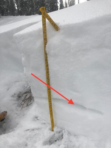
Red line in photo indicating weak layer at interface between latest large event and the second event from last week.
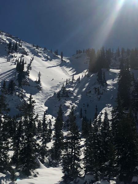
Excellent early season/shallow snowpack/powder riding on shady slopes above 8700 feet. Exits extremely challenging.
Today's Observed Danger Rating
Low
Tomorrows Estimated Danger Rating
Low
Coordinates