Observation Date
5/12/2018
Observer Name
Steenburgh
Region
Salt Lake » Little Cottonwood Canyon » Alta Ski Area » Upper Collins area
Location Name or Route
Collins Gulch/Alta
Weather
Sky
Overcast
Precipitation
Light Snowfall
Wind Direction
South
Wind Speed
Moderate
Weather Comments
In and out of clouds during morning tour. Winds were variable, with occasional strong gusts mainly from the south. Warm, but light snow was falling at Alta base at noon. Accumulation was about a trace at the parking lot overnight. A few inches up high.
Creamy and surprisingly fun on moderate angle above about 9600 feet. Snow slow as sandpaper below that.
Snow Characteristics
New Snow Depth
4"
New Snow Density
High
Snow Surface Conditions
Damp
Snow Characteristics Comments
Wet, high density snow on old spring snow surface. Latter not frozen to 10,450 ft.
Red Flags
Red Flags
Recent Avalanches
Red Flags Comments
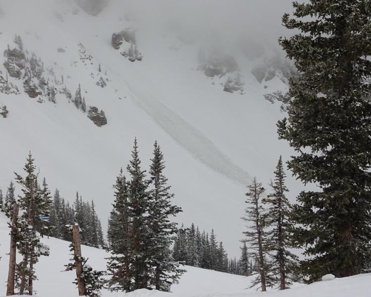
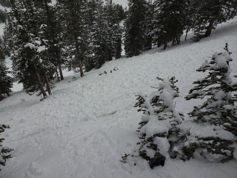
Noticed large slough from below Perla's into Ballroom on our second lap. Unsure if this was natural or human triggered. Probably not enough to bury someone, but such a high density, slough on a steep slope could take someone for a tough ride over rocks or a cliff. Extensive skier driven roller balling on other steep slopes. Some natural roller balling.
Avalanche Problem #1
Problem
Wet Snow
Trend
Same
Above photo shows slough into Ballroom.
Above photo shows extensive skier driven rollerballing in Race Course area. Roller balls soft today, but could yield miserable frozen coral reef conditions if it cools enough overnight to freeze.
Today's Observed Danger Rating
Moderate
Tomorrows Estimated Danger Rating
Moderate