Observation Date
4/30/2018
Observer Name
Al
Region
Salt Lake » Big Cottonwood Canyon » Silver Fork
Location Name or Route
Upper Silver Fork
Weather
Sky
Overcast
Precipitation
Light Snowfall
Wind Direction
Northwest
Wind Speed
Calm
Weather Comments
The first part of this storm was on its way out as we started mid morning. Lighter winds and some patches of blue sky by 14:00. A beautiful wintery day, temps right around freezing.
Snow Characteristics
New Snow Depth
5"
New Snow Density
Medium
Snow Surface Conditions
Powder
Snow Characteristics Comments
Snow was somewhere between dust on crust and powder. Needs some time to bind to the hard crust below.
Red Flags
Red Flags
Poor Snowpack Structure
Red Flags Comments
No huge red flags, but a lack of cohesion between old and new snow interface was the biggest issue today.
Avalanche Problem #1
Problem
New Snow
Trend
Decreasing Danger
Problem #1 Comments
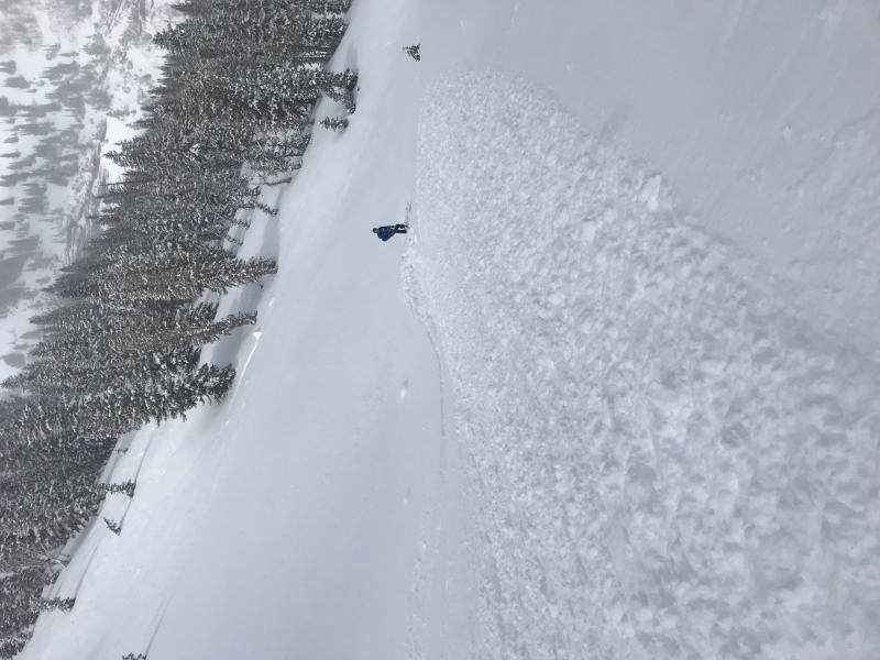
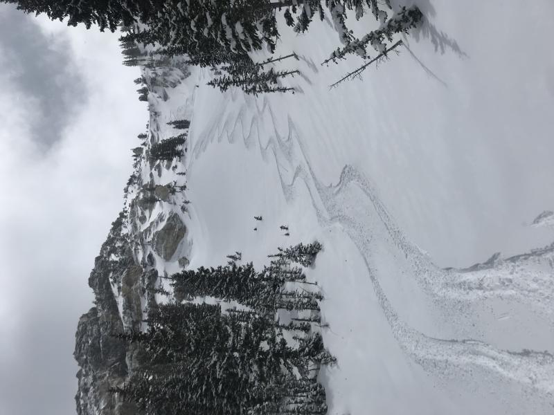
Considerable stuffing on slopes steeper than 38 degrees. There's enough snow out there to catch you if you're on a big face or heading into a terrain trap. Settlement and overnight bonding may reduce the ease of triggering loose snow by tomorrow.
Comments
Just like they tell you, today was one of those days were the safest and best riding is on lower angled, sheltered terrain. Anything steep will stuff to the old snow crust. Also, we learned the hard way that there are a lot of buried rocks just under the snow surface now. Be aware, you're skis will thank you!
Loose dry stuffing on Flanagans. Manageable but worth taking extra caution.
Great turns on lower angle slopes.
Today's Observed Danger Rating
Moderate
Tomorrows Estimated Danger Rating
Low