Observation Date
4/22/2018
Observer Name
Woody
Region
Provo » Provo Peak
Location Name or Route
Provo Peak
Weather
Sky
Clear
Wind Direction
Southwest
Wind Speed
Calm
Weather Comments
Temps have cranked up to almost 67deg at Aspen Grove today with temps on Provo Peak pushing into the 50's. There was little to no wind on the peak, but the wind vane was pointing toward the South.
Snow Characteristics
Snow Surface Conditions
Melt-Freeze Crust
Rain-Rime Crust
Damp
Snow Characteristics Comments
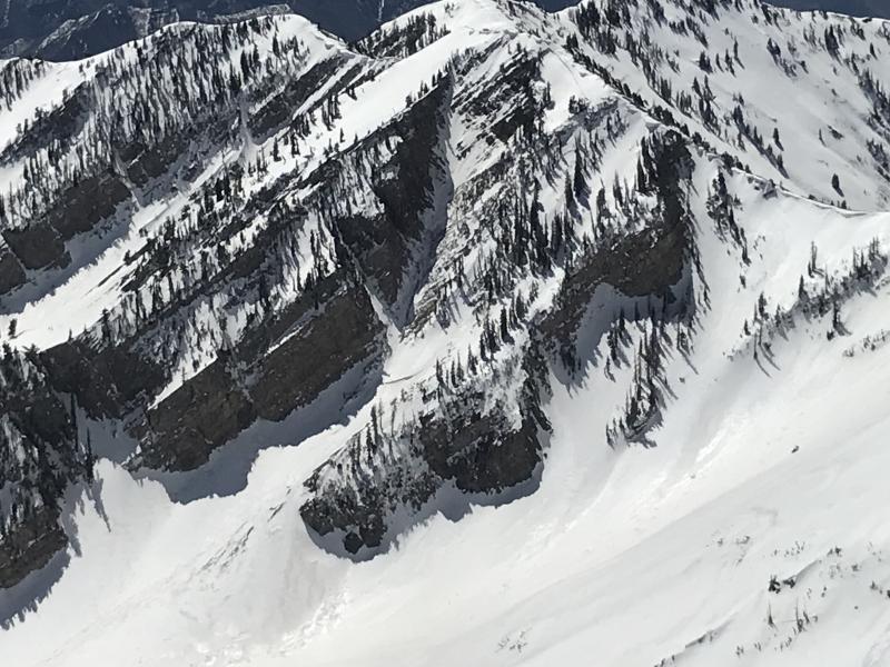
The snow from 8000' and up was surprisingly firm on the westerly faces, and ice hard on the North faces all the way up to 11000'. The snow on the WSW faces began to soften slightly by about 10am, however it remained supportable. Strong solar input, and high ambient temps have formed a stout MF/Sun crust that makes either booting, or ski crampons a must if you get on it early enough. Snow on the east side of Provo Peak down into Hobble Creek softened early, and WL slides were already starting around noon. WSW faces softened by noon on the west face of Provo Peak with the low elevation gullies turning to "mashed potato" snow on the south sides of the gullies.
Red Flags
Red Flags
Rapid Warming
Red Flags Comments
East - South faces are softening early, so timing will play a critical roll on these aspects. We have seen WL activity on these aspects from AF Canyon to Spanish Fork Canyon. NE faces still remain a big question mark. I was beginning to think that these aspects were on the mend, but we have seen several large avalanches that occurred in the past week on upper NE aspects in Slide Canyon, Big Springs, and now off of the Provo Peak Ridge line. The 8" thick rain/MF crust that formed a week or two ago has been bridging the garbage layers on the NE aspects, however eventually the warm temps are going to overcome that bridging and re-activate these week basal layers at the ground.
Avalanche Problem #1
Problem
Wet Snow
Trend
Increasing Danger
Problem #1 Comments
Increasing each day as temps rise. These have potential to trigger larger wet slabs or persistent slabs as they travel down the slope. East - SW aspects.
Avalanche Problem #2
Problem
Wet Snow
Problem #2 Comments
As the sun starts beating the East - South slopes the water will begin percolating down into the snow pack and potentially trigger wet slabs.
Comments
Generally the hazard is low with it rising to moderate on slopes prone to wet activity. Upper NE slopes should still be treated with caution. Hazard should stay at low tomorrow as long as we see a surface refreeze tonight. Clouds associated with tomorrows quick storm should keep wet activity down as long as the ambient temps don't get too out of hand. For the most part everything in the Southern Wasatch below 8000' is melted out and dry.
Today's Observed Danger Rating
Low
Tomorrows Estimated Danger Rating
Low