Observation: Bear Trap

Observation Date
4/8/2018
Observer Name
Reed Sullivan
Region
Salt Lake » Big Cottonwood Canyon » Bear Trap
Location Name or Route
Beartrap
Weather
Sky
Obscured
Precipitation
Light Snowfall
Wind Direction
Northwest
Wind Speed
Light
Weather Comments
Sminus1 to S1 snowfall throughout the day. Light wind was transporting the new snow on the ice crust. The skin track was filled in every lap where wind was being transported.
Snow Characteristics
New Snow Depth
3"
New Snow Density
Medium
Snow Characteristics Comments
Snow surface was ~2" of graupel at the start of the day. ~4" when I left around 3pm. Decent riding conditions on low angle terrain if you could stay off of the ice. New snow was not bonding to the ice at all.
Red Flags
Red Flags
Poor Snowpack Structure
Red Flags Comments
Under the new snow, there was a ~5" layer of firm and frozen snow, directly under that was damp snow that was fist hardness.
Avalanche Problem #1
Problem
New Snow
Trend
Decreasing Danger
Problem #1 Comments
I started 3 loose snow slides towards the end of the day, all starting zones 30 to 32 degrees. 2 of them ran until they hit trees below. One of them just stopped. These could be dangerous in steeper terrain and make for an icy ride down since it was taking all of the snow above the ice. Pictures below.
Avalanche Problem #2
Problem
Wet Snow
Trend
Increasing Danger
Problem #2 Comments
I'm not sure how this damp snowpack is going to react as the temps increase this week. But, with only 5" of frozen snow, I would imagine the snowpack will heat up quickly.
Comments
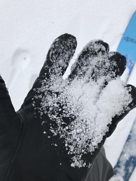
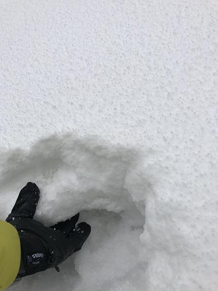
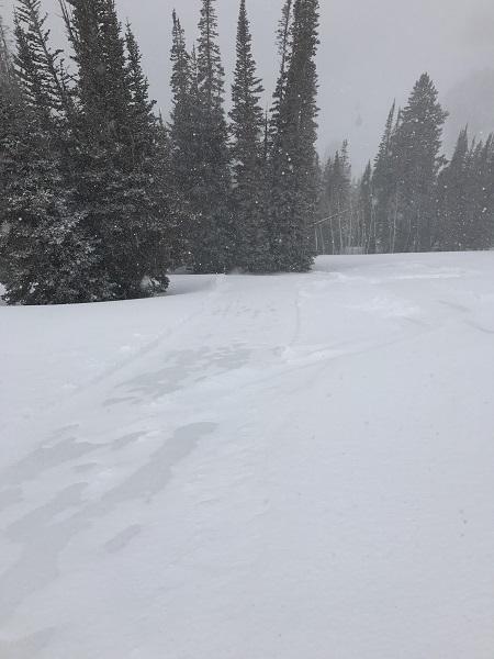
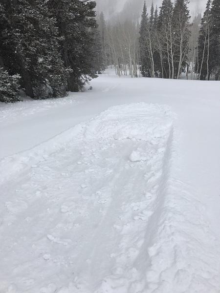
photos: new snow, ice crust with damp snow underneath, sluff running to trees, short running sluff.
Today's Observed Danger Rating
None
Tomorrows Estimated Danger Rating
None