Observation Date
3/19/2018
Observer Name
T.Matthews
Region
Moab
Location Name or Route
Laurel Highway to Goldminer's.
Weather
Sky
Scattered
Wind Direction
Northwest
Wind Speed
Light
Weather Comments
We started our tour from the Geyser lot at 9:30am. The sun was shinning and the winds were light. As were made are way up the Laurel Highway to the weather station some clouds had moved in and created scattered to broken skies. Winds above treeline along the ridge remand light and out of the NW. I didn't note any blowing snow all day long. Although, it was obvious that it had blown. Temps seemed to remain below freezing all day, but with the sun high in the sky the solar aspects got damp.
Snow Characteristics
New Snow Depth
16"
New Snow Density
Low
Snow Surface Conditions
Powder
Damp
Snow Characteristics Comments
The snow on the northerly aspects stayed cool and dry all day. The southerly aspects got hit hard and by noon they were damp. By the time we were exiting Gold Basin the solar aspects were quite damp. We needed skin wax to fight the glob.
Red Flags
Red Flags
Recent Avalanches
Heavy Snowfall
Wind Loading
Poor Snowpack Structure
Red Flags Comments
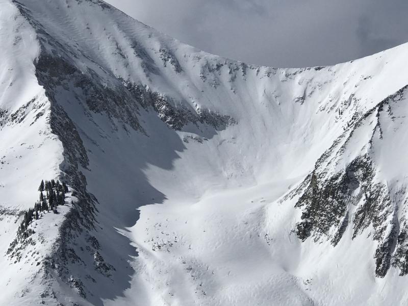
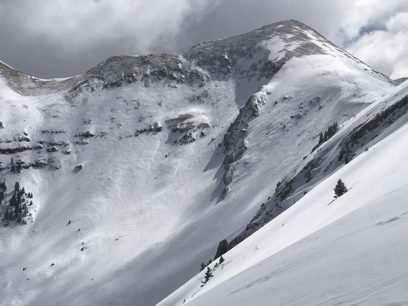
With 16 plus inches of new snow in the past 24 hours the buried persistent layers have received a rapid load and I'd imagine in areas have become reactive again. The wind certainly moved snow around during the storm. It was evident all over the place and it was not confined to ridges. Cross loaded slopes well below the high alpine terrain was easy to spot. I noticed a few pretty long running loose dry avalanches, and a few storm snow avalanches. Judging by how much the crowns, or flanks were filled in looked to have run early, or mid storm with the exception of one.
Avalanche Problem #1
Problem
Wind Drifted Snow
Trend
Decreasing Danger
Problem #1 Comments
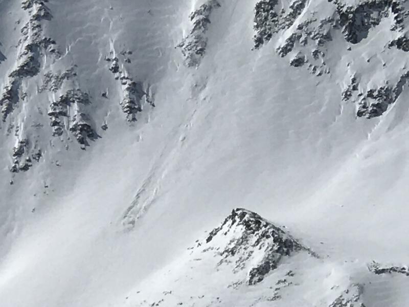
The winds took their toll on the snow surface in areas. I toured during the storm yesterday and for the most part the winds were quite well behaved. The snow was falling mostly straight down. I did see areas yesterday that were fat and rounded, but did not shoot any cranks out in front of our skies. The slabs just weren't that stiff. Today the same loaded areas were stiffer, but still no shooting cracks. The largest natural avalanches that I saw today was on the NE face of Mt. Tukuhnikivatz. The avalanche pulled out under a large cliff band that had certainly seen some wind, but I couldn't really tell if it was a wind slab, or a storm slab. The crown looked pretty uniform, but I was a long way away and used my camera to super zoom in.
Avalanche Problem #2
Problem
Persistent Weak Layer
Trend
Same
Problem #2 Comments
Yesterday we dug in the snow in a thin wooded area on a NE facing slope at 11,000 feet and had 2.5mm to 3mm basal facets that were reactive in ECT's. Today I didn't put myself in any steep NW,N,E facing terrain. I feel pretty certain that if I did it would ruin my day. I think that as these PWL adjust to the load of the new snow they will become harder to trigger, but if triggered will remain unmanageable large avalanches up to 4' deep.
Comments
What a beautiful day for a tour. Light winds, lots of new low density snow and good people to ski with. I was actually surprised I didn't observe more widespread natural avalanche activity. The natural activity that I did see seemed to stay within the new storm snow, or wind effected snow. I was also, surprised to see these avalanches not pull out in to older snow.
1. NE facing Tukuhnikivatz natural.
2. Cross loading on Mt. Mellenthin.
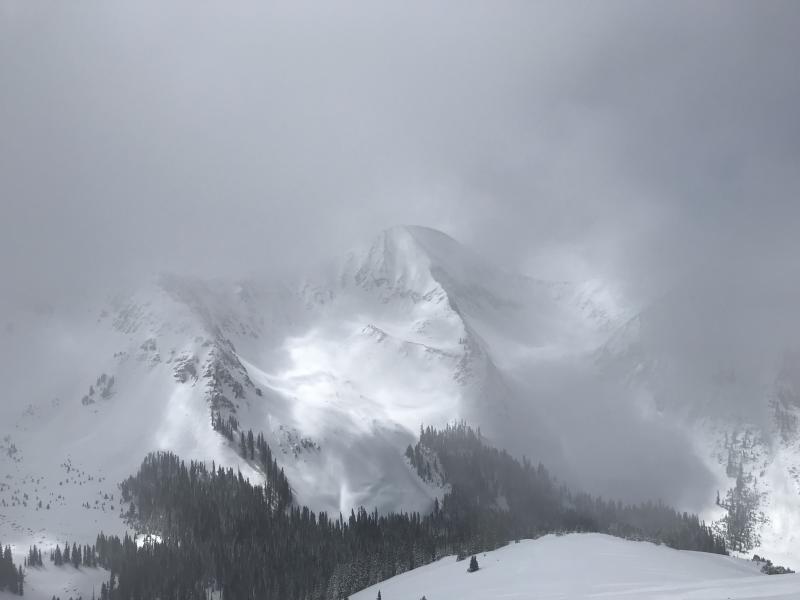
3. Clouds rolling in.
4. Faint remains of a natural that ran early on during the storm. Another area super cross loaded.
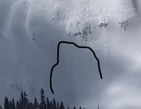
5. Long running loose dry avalanche.
Today's Observed Danger Rating
Considerable
Tomorrows Estimated Danger Rating
Considerable