Observation Date
3/16/2018
Observer Name
Ted Scroggin
Region
Uintas » Mirror Lake Highway » Bald Mtn Pass
Location Name or Route
Bald Mt. Murdock Peak
Weather
Sky
Scattered
Wind Direction
Southeast
Wind Speed
Light
Weather Comments
Much colder this morning at the trail head with teens and a decent refreeze overnight. Partly cloudy for the first half of the day with mostly cloudy skies and southeast winds were picking up around 2pm.
Snow Characteristics
New Snow Depth
12"
New Snow Density
Medium
Snow Surface Conditions
Powder
Wind Crust
Snow Characteristics Comments
Only an inch or so overnight, but up near Bald Mt. a nice foot of new medium density snow to freshen things up from Wednesdays storm.
Red Flags
Red Flags
Recent Avalanches
Wind Loading
Poor Snowpack Structure
Red Flags Comments
Many slopes around the Murdock and Bald Mt. area had recent new snow sluffing with a few breaking into some older snow as they moved down hill. Winds on the ridge lines were moving the new snow, but generally light winds elsewhere until early afternoon when the southeast winds picked up.
Avalanche Problem #1
Problem
Persistent Weak Layer
Trend
Increasing Danger
Problem #1 Comments
No recent avalanche activity that involved the weak layers buried in the snow pack, but many slopes are thin and have a weak snow pack structure in the Bald Mt. area. The stability was generally good today, but it is a thin snow pack winter and with another storm on the way more weight and stress is added increasing the avalanche danger.
Avalanche Problem #2
Problem
Wind Drifted Snow
Trend
Increasing Danger
Problem #2 Comments
Winds today were blowing the new snow into shallow and generally manageable wind slabs, but the winds were picking up this afternoon and these wind slabs will likely be deeper and wider with the approaching storm.
Snow Profile Comments
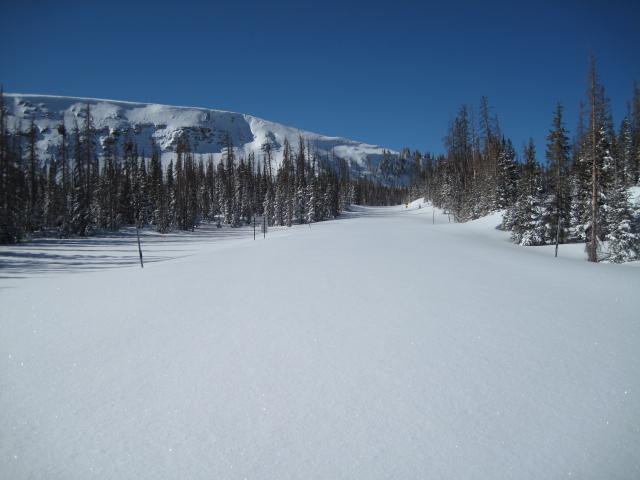
Beautiful winter like day up on the pass with a foot of new snow.
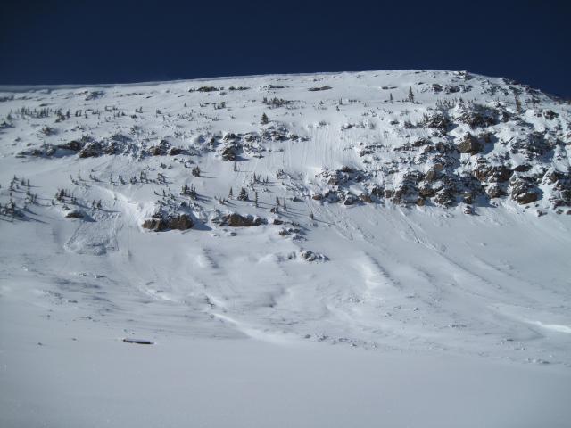
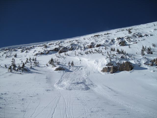
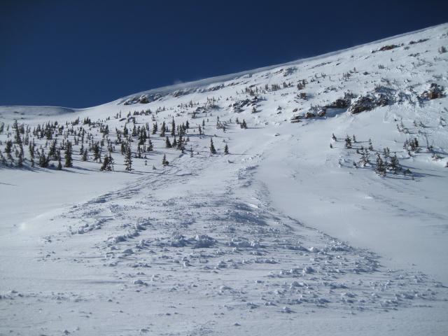
Noticed these recent slides on the north side of Murdock Peak today. Mainly storm snow sluffs that started as shallow wind slabs or minor slufing that entrained the new snow as they moved downhill. One of these did appear to brake into some deeper weaker snow leaving a nice debris pile.
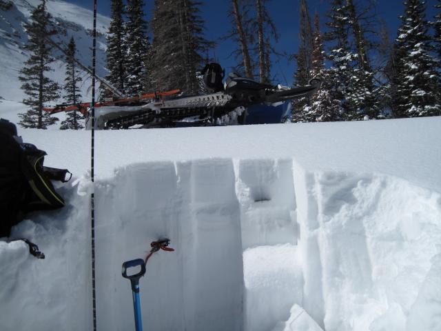
A quick snow pit in the Murdock area shows the recent snow with two distinct weak layers marked with the saw and card. Maybe not enough weight from the past storm to stress these weak layers, but wet heavy snow is forecasted and could tip the scales??
Today's Observed Danger Rating
Moderate
Tomorrows Estimated Danger Rating
Considerable