Observation Date
3/5/2018
Observer Name
jg
Region
Uintas » Upper Weber Canyon
Location Name or Route
Upper Weber Canyon
Weather
Sky
Overcast
Precipitation
Light Snowfall
Wind Direction
West
Wind Speed
Moderate
Weather Comments
Mostly overcast skies today but by the end of the day the clouds were scattered. Light snow with maybe an inch of accumulation during the day. Winds were moderate from the NNW early but switched to the west and were moving snow around. Teens at 9K and single digits at 10K. Felt cold today with the chilly temps, cloud cover and moderate winds.
Snow Characteristics
New Snow Depth
3"
New Snow Density
Low
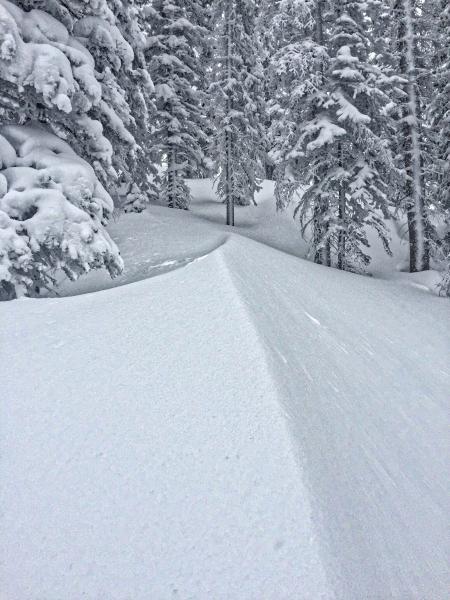
Snow Surface Conditions
Powder
Snow Characteristics Comments
Hard to say but maybe 3"-6" overnight.
Red Flags
Red Flags
Heavy Snowfall
Wind Loading
Cracking
Poor Snowpack Structure
Red Flags Comments
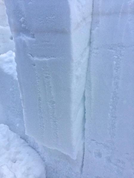
A few red flags but nothing alarming. Kept in mind the prefrontal winds before the storm. Cracking was minimal. The new snow did not seem reactive in pit tests or while traveling or skiing. The snowpack structure is still poor but in the area I traveled there was almost 6 feet of snow and the buried weak layers seem to have adjusted to the weight of the pack above.
Avalanche Problem #1
Problem
Persistent Weak Layer
Trend
Same
Problem #1 Comments
Not much new to mention here. In the area traveled, I was feeling the bridging effect of the deeper snowpack was helping reduce the likelyhood of a persitant slab avalanche.
Avalanche Problem #2
Problem
Wind Drifted Snow
Trend
Same
Problem #2 Comments
Not sure what the winds are supposed to do tonight and tomorrow but there's no shortage of light snow to move around.
Snow Profile
Aspect
Northwest
Elevation
9,800'
Slope Angle
28°
Comments
I had more snow at my house in Oakley than was at the 1000 Peaks gate (7400 ft.) but once you gained a litte elevation the snow started stacking up. Kept to mostly lower angle terrain but jumped onto some steeper slopes with no problems. The storm slab seemed well bonded to the old snow surface and there was some sluffing in the new snow but it was minor.
In the next few days the sun could be a factor in snowpack stability.
Lots of "whalebacks" on the lee side of trees in the upper elevations from the strong winds.
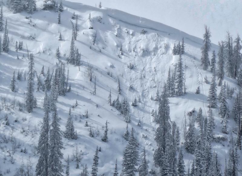
Repeater on an east facing slope.
Today's Observed Danger Rating
Moderate
Tomorrows Estimated Danger Rating
Moderate