
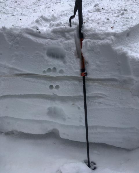
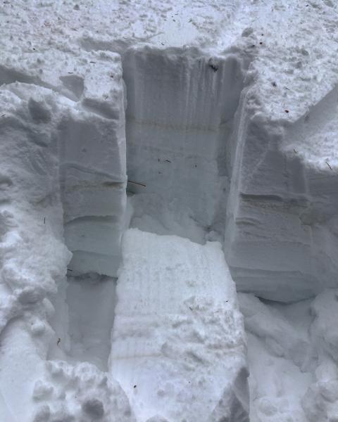
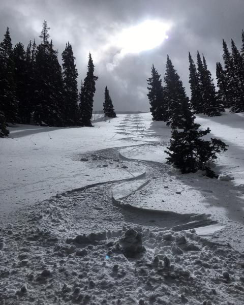
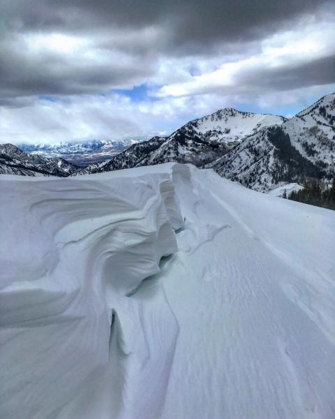
Headed up Mill D to try to stay out of the wind and find some protected snow to ski. The wind was not too bad down in the drainage but was in the strong category up on top of Reynolds peak, and it looked quite a bit stronger and moving allot of snow in the high alpine, especially in upper Broads and Cardiff. There's not much snow to move on the S facing on Reynolds, it's mostly dirt on the S and SW so there wasn't allot of wind loading or fresh wind slabs in the terrain covered. The snow on the protected north was dense settled powder with boot deep penetration. Its been a while since I dug a snow pit so I decided to take a look at the snow pack structure on a N facing wind protected slope at 9,000ft, 32 degrees in steepness. The total snow-pack is just over 3 feet deep, there's still 5 inches of loose facets at the ground interface, I was expecting the February crust to be the weakest layer in the pack but was surprised to get failure upon isolation on the facets at the ground in the two columns I tried to isolate, and they also popped out with a decent amount of energy. I would think if we get a large load, 3 inches of water or more these facets in the basement might reactivate in the thin snow-pack areas such as Mill D. I skied the NE face of Reynolds on the way out, first ski cutting the top for wind slabs with no results, I was a bit surprised that the NE face had a thin heat induced zipper crust top to bottom which might tend to hold more weight and increase the size of any avalanche activity.
Photos: Sow pit, and pit location, cornice formation on the ridge.
Considerable seemed right for the alpine, moderate for mid elevations today, thinking considerable if we get the snow forecasted tomorrow


