Planned Website Outage: The UAC website will be down for maintenance on June 17 from 2:00 - 7:00 PM MT.

Observation: Little Cottonwood Canyon

Observation Date
2/23/2018
Observer Name
Wilson, Hardesty
Region
Salt Lake » Little Cottonwood Canyon
Location Name or Route
Upper LCC
Weather
Sky
Overcast
Precipitation
Light Snowfall
Wind Direction
Northwest
Wind Speed
Light
Weather Comments
Cold, probably single digits up high. What little wind there was had already swung to the Northwest from the SSE by the afternoon. Light snowfall at first, falling away in the afternoon. Moments of sunlight.
Snow Characteristics
New Snow Depth
5"
New Snow Density
Low
Snow Surface Conditions
Powder
Snow Characteristics Comments

Light unconsolidated powder was easy to push a pole basket through, all the way down to the dirt layer and crust that preceded Monday's storm. Small snow crystals falling mid-day. In the city, at least, the final inch of snow was a dramatic change to large light stellars.

Red Flags
Red Flags
Poor Snowpack Structure
Red Flags Comments
Structure not actually bad on SE where we dug a quick pit; just guessing it remains junky to the North.
Avalanche Problem #1
Problem
New Snow
Trend
Decreasing Danger
Problem #1 Comments

We kicked small chunks of cornice--sending it north into the Silverfork headwall--and entrained the top 2-3" of snow in small, not-too-far-or-fast running sluffs. Looked as though a few natural cornice falls had similar results earlier. Shovel burp tests on the Monday-through-Friday snow failed to identify a clean or easy shear layer, at least by the time we tested at 3pm. Nothing like the widespread naturalling within the new snow we saw on Monday. We didn't check to see if North aspects had seen faceting before this round of snow and might have yielded different results.

Snow Profile
Aspect
Southeast
Elevation
9,400'
Slope Angle
28°
Comments

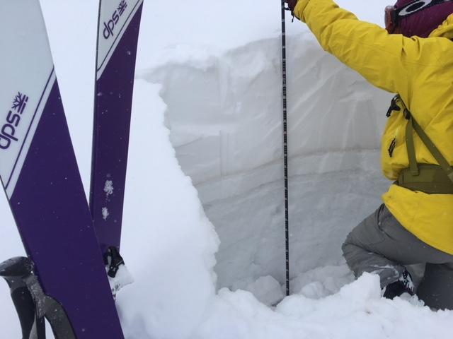
After the SE facing persistent slab avalanche in Wilson Chutes, thought we might at least dig on a southerly aspect to look at structure. Unlike the Millcreek area, dry facets were nearly absent in this section of SE 9400' snowpack. The snow since Monday is still fist-hard. Under the pre-Monday dirt was a 1.5cm crust (barely felt it skiing) with small facets below. Below that, a 2.5" crust of seriously large grained melt forms was hard to saw through, let alone initiate a fracture through. ECTN31.

Note that in a shallower south facing location shaded by a limber pine, there were looser dry facets and a CT21; a reminder that South only acts like south if it sees solar input. If we find ourselves on a south aspect with significant terrain shading I might spend a bit more time probing.

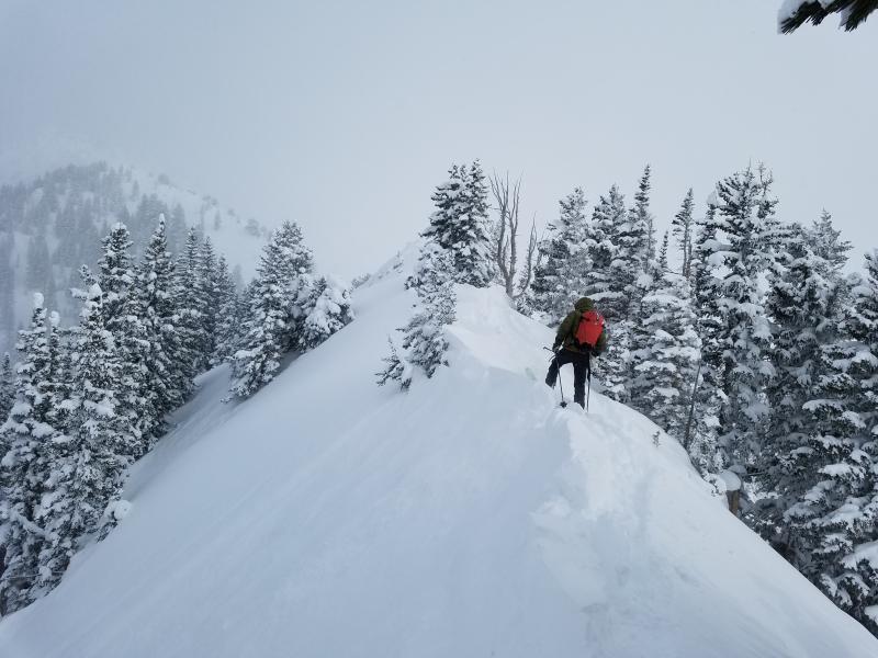
No wind loading to speak of. The weighted limbs of a ridge-top limber pine speak to basically calm conditions.

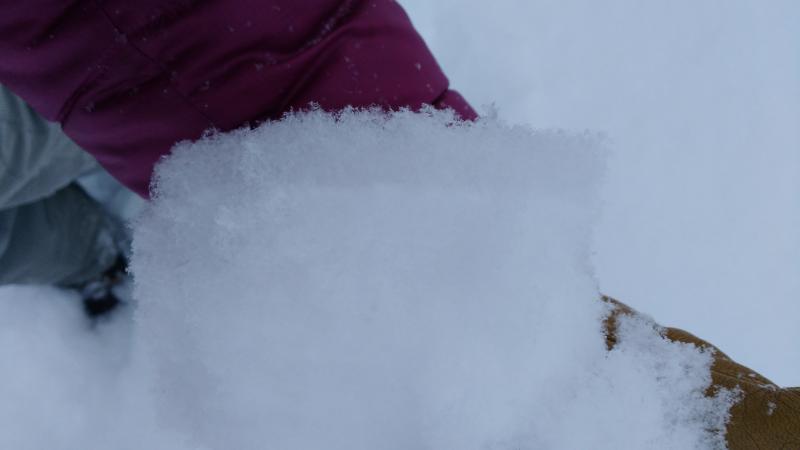
Change in crystal type, here in the Avenues at least: the final inch is fluffier and less dense, made up of long-armed stellars. Finally, something to kick through in the neighborhood streets...

Today's Observed Danger Rating
Moderate
Tomorrows Estimated Danger Rating
Moderate
Coordinates