Observation Date
2/15/2018
Observer Name
J. Rowell
Region
Salt Lake » Park City Ridgeline » Home Run
Location Name or Route
Home Run
Weather
Sky
Overcast
Precipitation
Heavy Snowfall
Wind Direction
Northwest
Wind Speed
Light
Weather Comments
Snowfall off and on, heavy at times. Close to 15 inches of new at 2 o'clock. Sun poked its head out around 3 for a few minutes.
Snow Characteristics
New Snow Depth
13"
New Snow Density
Low
Snow Surface Conditions
Powder
Snow Characteristics Comments
If you need to ask...
Red Flags
Red Flags
Heavy Snowfall
Poor Snowpack Structure
Red Flags Comments
It's been a couple weeks since I've dug a pit in the backcountry, and I was surprised and disappointed to still see such a significant weak layer of facets from November/December buried deeper with the new storm snow. We also observed large drifts and cornices along the Northern Park City Ridgeline, those of which we stayed away from.
Avalanche Problem #1
Problem
Persistent Weak Layer
Trend
Same
Problem #1 Comments
Same old story. Sugary snow buried 60cm in the snowpack beneath a stout crust. We heard accounts of new snow sluffs running fast and long in steep terrain, but we did not experience this. We also did not encounter any significant wind slabs on this slope, despite being on the leeward aspect.
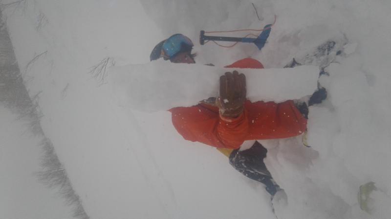
Snow Profile
Aspect
East
Elevation
9,200'
Slope Angle
31°
Comments
We found a very stout crust mid snowpack, pencil hardness, 12cm thick. Our two ECT's did not produce results until 25/26 taps, when the layer right below the crust failed. This lead us to believe that this crust is strong enough to prevent failures on the weak snow below it until there is a more significant load, or it is triggered at a spot the crust is thinner.
Today's Observed Danger Rating
Moderate
Tomorrows Estimated Danger Rating
Moderate