Planned Website Outage: The UAC website will be down for maintenance on June 17 from 2:00 - 7:00 PM MT.

Observation: Park City Ridgeline

Observation Date
2/15/2018
Observer Name
mark white
Region
Salt Lake » Park City Ridgeline
Location Name or Route
PC Ridgeline
Weather
Sky
Obscured
Precipitation
Moderate Snowfall
Wind Direction
Northwest
Wind Speed
Moderate
Weather Comments
Cold with obcurred skies most of the day and low visibility, light to sometimes intense snowfall rates, producing both graupel and stellars. Moderate wind speeds out the W-NW loading the light density snow on leeward slopes, forming dense wind drifts on the ridge line along with sensative cornices.
Snow Characteristics
New Snow Depth
12"
New Snow Density
Low
Snow Surface Conditions
Powder
Snow Characteristics Comments

The PC ridge line received at least a foot of new snow, maybe more, hard to tell with the wind transport. The snow was light density and right side up cold smoke. Started with about 8 inches at the Solitude parking lot increasing depth with elevation gain.

Red Flags
Red Flags
Heavy Snowfall
Wind Loading
Cracking
Poor Snowpack Structure
Red Flags Comments
Heavy snowfall, wind loading, poor visibility, being solo and cracking in the drifted snow was enough to keep me out of the bigger N facing lines such as the Monitors.
Comments

Seemed like a real winter day today, travel was up Willow Heights across West Monitor a run or two on the sub-ridge then across South Monitor to USA Bowl and out. The new snow seemed fairly well behaved, there was some long running sluffs in West Monitor produced from cornice fall but no real slab activity noted, keep in mind the visibility was extremely poor. The cornices in both S and W Monitor were extremely sensitive and would crack out on approach but didn't seem to produce any avalanche activity either. Like I stated before the wind loading was keeping me suspect of the steeper lines which I avoided. The new light density snow was not adding a whole lot of weight but when you combine new snow with rapid wind loading creating stiffer drifts the weight starts to add up quickly.

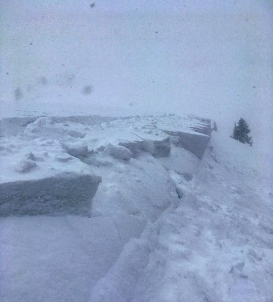
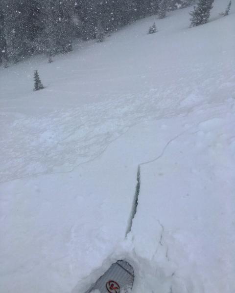
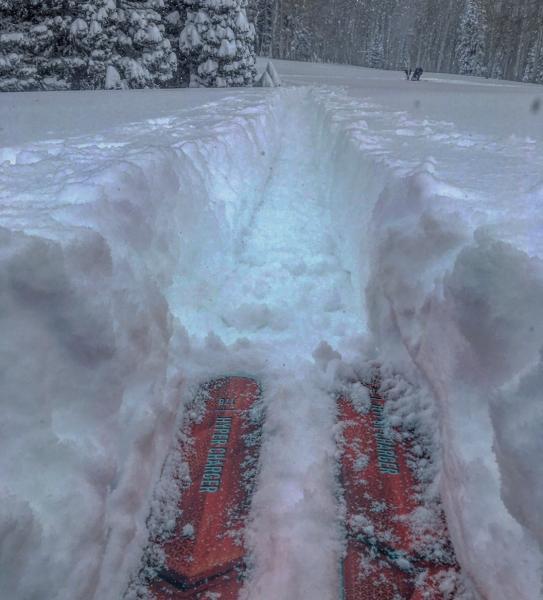
Photos: sensitive cornices breaking upon approach but producing no avalanche activity, cracking in the wind drifts on the ridge line, and trail breaking through deep snow which is a oddity this year

Moderate sounds about right for today but if the wind continues to blow and we get more snow tonight the hazard might increase

Today's Observed Danger Rating
Moderate
Tomorrows Estimated Danger Rating
Moderate