Observation Date
1/21/2018
Observer Name
T. Matthews D. Garcia
Region
Moab
Location Name or Route
Laurel Highway to Pre Laurel Peak Ridgeline
Weather
Sky
Overcast
Precipitation
Light Snowfall
Wind Direction
North
Wind Speed
Moderate
Weather Comments
We were surprised to see as much snow as we did in the Geyser parking lot. I measured roughly 40cm of new snow in the parking lot. Light snowfall continued throughout the day with as we made our way up the Pre Laurel Highway. Winds were light below treeline with the occasional gust that blew the light density snow right off the trees. Temperatures seemed to stay in the teens most of the day. North winds above treeline along the Pre Laurel Peak Ridgeline were mostly in the moderate rate with the occasional gust. Transporting the low density snow very easily one the south half of the compass.
Snow Characteristics
New Snow Depth
15"
New Snow Density
Low
Snow Surface Conditions
Powder
Snow Characteristics Comments
The light density snow was pretty easy to break trail in today. It pushed out in front of the skis quite easily despite being quite deep. A lack of a real base had us punching through even deeper than the new snow in areas.
Red Flags
Red Flags
Heavy Snowfall
Wind Loading
Cracking
Collapsing
Poor Snowpack Structure
Red Flags Comments
Dave and I experienced widespread collapsing and cracking throughout the day. In most areas we walked in we felt something collapse. The largest collapse of the day occurring along then Pre Laurel Peak Ridgeline in the flats above the Coyote Chutes. It was loud and we both felt it standing about 50 feet apart. Although, this did not crack out at all. One of the few that didn't. Along the Pre Laurel Ridge above tree line the winds were moderate with strong gusts transporting snow from the north to the south loading up the Funnel starting zones.
Avalanche Problem #1
Problem
Persistent Weak Layer
Trend
Same
Problem #1 Comments
With a poor snowpack structure and the weight of the new snow. I agree we are starting to see a persistent slab avalanche problem. With ECT results failing on a couple different interfaces within the snowpack. Near mid pack and at the basal facets we simply just need a bit more of a load on those weak layers before we see a natural cycle occur. The winds may have helped that out today above treeline.
Avalanche Problem #2
Problem
Wind Drifted Snow
Trend
Increasing Danger
Problem #2 Comments
Lots of light density snow for transport. Winds along the Pre Laurel Peak Ridgeline at 11,500 feet were moderate with strong gusts. Blowing out of the north and loading the southern half of the compass. The starting zones above the Funnel were getting pretty loaded up. We didn't poke around the wind pillows at all and didn't spend much time up on the ridge. With the winds blasting us with snow and the cold temps we peaced out pretty quick to gain the shelter of terrain below treeline.
Snow Profile
Aspect
Northwest
Elevation
11,200'
Slope Angle
26°
Video
Video of an ECT on Prelude just above the North Woods. The first ECT we did failed on a NSF layer just above a small crust mid pack. We thought it was strange that it didn't fail on the Basel facets, so we repeated another ECT. This time we got an ECTP 14 SC on the basal facets. Did another ECT which is this video. ECTP 13 SC. which in the video I believe I scored it a 14. Note worthy! As we skied in to this area off the Pre Laurel Ridge we had 2 large cracks shoot out just below our pit site as we came to a stop.
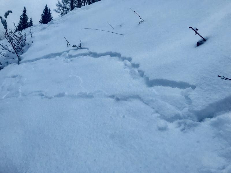
Photo: 1. One of the many shooting cracks we experienced after a collapse on a test slope.
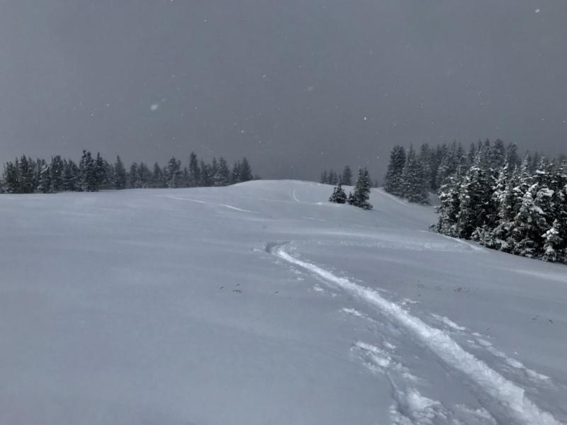
Photo: 2. The skin track above The Coyote Chutes were we had our hardest and loudest collapse of the day. No cracking.
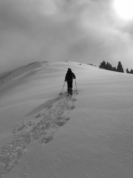
Photo: 3. Dave Garcia making his way up the Pre Laurel Ridge just below where the were winds were cranking.
Today's Observed Danger Rating
Considerable
Tomorrows Estimated Danger Rating
Considerable