Observation: Lake Peak

Observation Date
1/21/2018
Observer Name
Toddeo
Region
Southwest » Tushers » Lake Peak
Location Name or Route
Tushers - Lake Peak
Weather
Sky
Broken
Precipitation
Light Snowfall
Wind Direction
North
Wind Speed
Strong
Weather Comments
PDW! Cold day, about as cold as it gets here in Utah, I walked with a puffy and goretex all day and did not sweat. Cleared in the late afternoon. Temps in the teens with winds gusting to 30 mph or so.
Snow Characteristics
New Snow Depth
10"
New Snow Density
Medium
Snow Surface Conditions
Powder
Wind Crust
Snow Characteristics Comments

6-10" new, hard to tell in some locations due to wind.

Red Flags
Red Flags
Wind Loading
Cracking
Collapsing
Red Flags Comments
Wind was loading most of the day until it cleared in the pm. Drifts up to 2" deep. Wind slabs up to 8" thick but mostly in the 2-4" range, mostly soft. 2 large collapses right as I left the closed Eagle Point runs, with cracking up to 20', only 2 of the day, this surprised me. Lot's of soft, non-shooting cracks in recent wind slabs, no propagation. I was expecting much more in the red flags department. I walked through many suspect areas without very much reaction. It was difficult to isolate the upper wind slab in many areas, when I did most were ECTP (photos below) The good news is that I did not see widespread areas of faceted basal snow. I think this is due to the lack of early season snow. The worst facets I found were below a crust at 11,000' on a west aspect (see snow profile below), I tried 2 EC's and both were ECTN in the facets.
Avalanche Problem #1
Problem
Wind Drifted Snow
Trend
Same
Problem #1 Comments

Wind slabs in exposed areas near and above treeline.

Considerable hazard in wind exposed areas.

Avalanche Problem #2
Problem
Normal Caution
Problem #2 Comments

Normal caution for a very thin snow pack.

Snow Profile
Aspect
West
Elevation
11,000'
Slope Angle
30°
Comments

HS is about a foot in this area. Facets at base are overlain by a knife-hard crust directly above top of glove. Upper 1" is a wind slab. This area is very variable and is often scoured. Crust is supportable for skiing.

Overall HS ranges from 12-18"
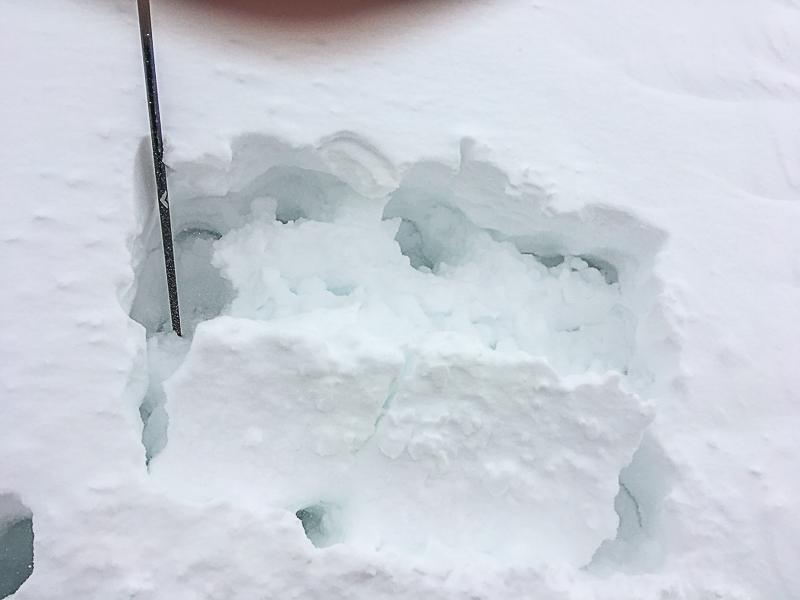
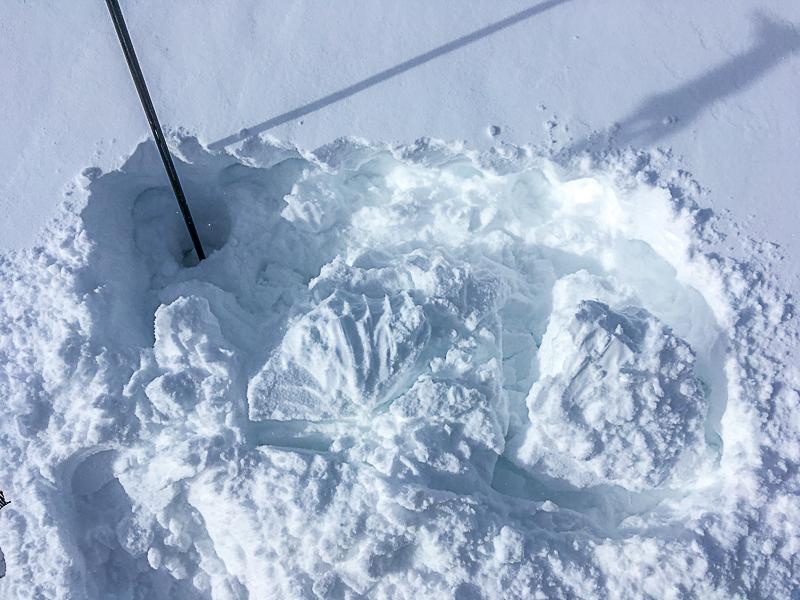
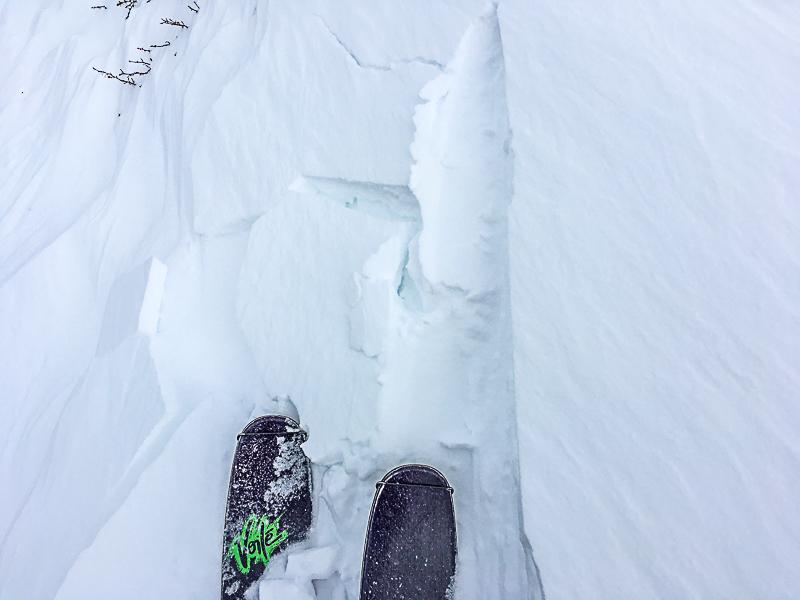
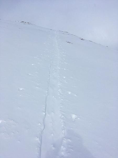
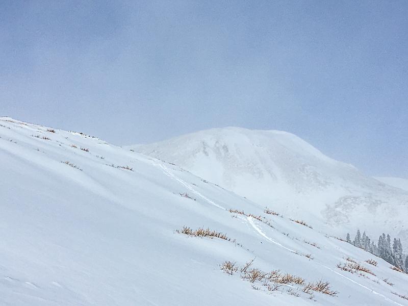
Photos below:

1&2 - Examples of wind slabs in quick ECTs

3 - Surface cracking

4 - Wind affect in skin track on short re-hikes.
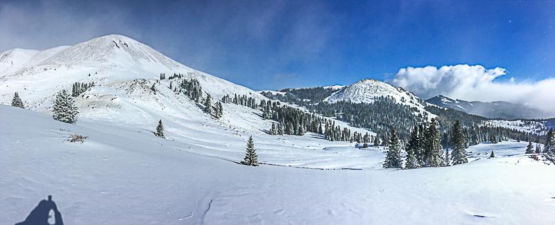
Photos below:

1 - Mt. Holly on left and Lake Peak in background.

2- Typical terrain near Eagle Point, Mt. Holly in background.

If anyone wants to get in touch with me about snow/avalanche questions in SW Utah, I can be reached at [email protected]. I would be happy to walk anyone through the observation process. All observations are appreciated.

Eagle Point is trying hard to open but the lack of snow is stopping them, it is not from lack of effort. They are located on private land and do not permit skiing on closed runs.

Overall I was surprised by the general lack of reactivity in the snow pack, it was not for the lack of prodding.....That being said, I did see enough hints to be able to call the hazard considerable at and above treeline. Moderate below tree line.

Today's Observed Danger Rating
Considerable
Tomorrows Estimated Danger Rating
Considerable
Coordinates