Observation Date
1/19/2018
Observer Name
Hardesty, Wilson, Cookler
Region
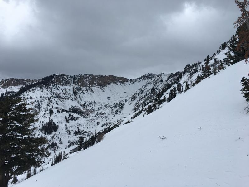
Salt Lake » Big Cottonwood Canyon » Mineral Fork
Location Name or Route
Mineral Fork
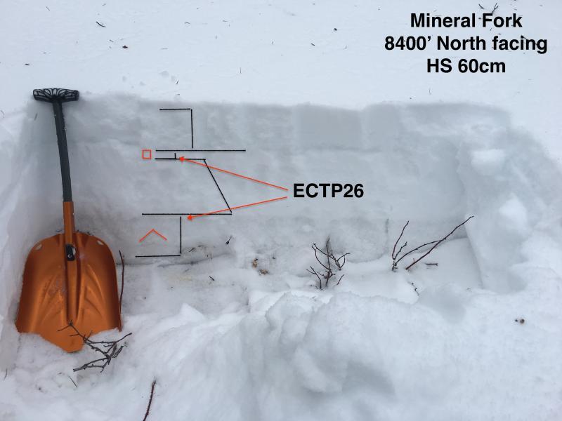
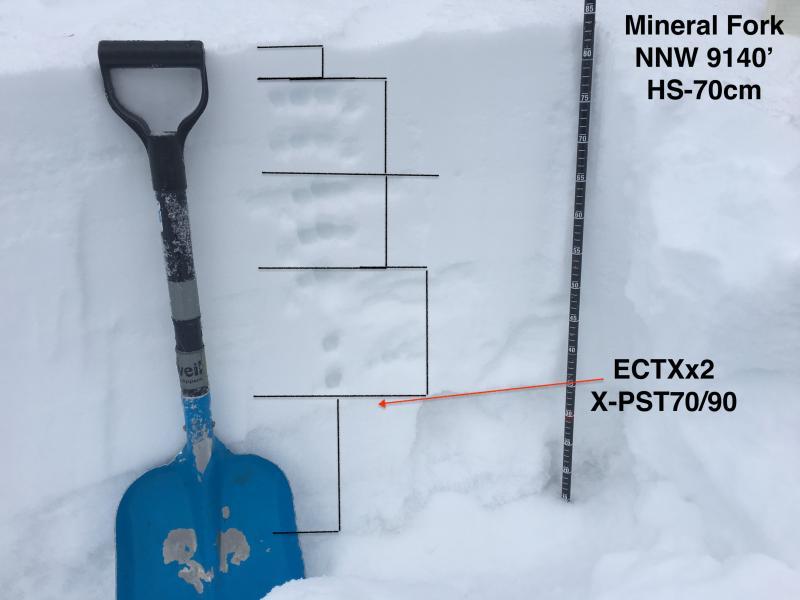
Comments
Two profiles plus thin snow conditions in upper Mineral.
Today's Observed Danger Rating
Moderate
Tomorrows Estimated Danger Rating
Considerable