Observation Date
1/10/2018
Observer Name
Luke
Region
Salt Lake » Little Cottonwood Canyon » Grizzly Gulch
Location Name or Route
Grizzly Gulch
Weather
Sky
Obscured
Precipitation
Heavy Snowfall
Wind Direction
Northeast
Wind Speed
Strong
Weather Comments
Northish wind blowing at a good clip most of the morning, it really picked up above 9500' and was doing a fine job of depositing the new snow all over the place.
Snow Characteristics
New Snow Depth
12"
New Snow Density
Medium
Snow Surface Conditions
Powder
Dense Loose
Snow Characteristics Comments
The snow that was falling was mostly nice and fluffy with some bursts of graupelish snow when the wind picked up. Wind relocated snow was on the denser side.
Red Flags
Red Flags
Recent Avalanches
Heavy Snowfall
Wind Loading
Cracking
Collapsing
Poor Snowpack Structure
Red Flags Comments
Much the same as the last couple of days, but the amount of snow is problematic as it becomes more cohesive, there are a couple of rotten layers for it to fail on.
Avalanche Problem #1
Problem
New Snow
Trend
Same
Problem #1 Comments
Lots of new snow for the current situation, it could push you into rocks or trees if it broke out but I would be more worried about anything stepping down into lower layers.
Avalanche Problem #2
Problem
Persistent Weak Layer
Trend
Increasing Danger
Problem #2 Comments
There are a number of poor layers in the snowpack any of which could fail fairly easily depending on where you are at, slope steepness, what's under it, etc. as well as the terrible faceted bottom 10cm of the snowpack.
Snow Profile
Aspect
Northeast
Elevation
9,600'
Slope Angle
30°
Comments
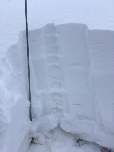
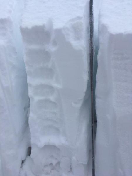
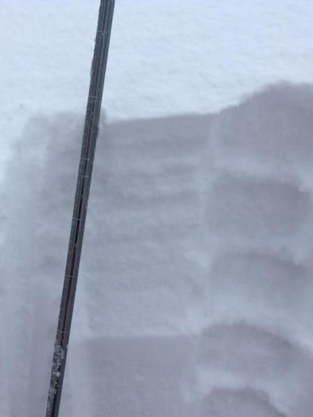
Dug a pit NNE about 29/30 degrees right below a subridge so it had some wind loading. Total depth 100 cm, below are pictures of the layers and the shovel shear failure at 38 cm (not where I was expecting, however it was a noticeable hard/ weak layer interface).
Today's Observed Danger Rating
High
Tomorrows Estimated Danger Rating
High