Planned Website Outage: The UAC website will be down for maintenance on June 17 from 2:00 - 7:00 PM MT.

Observation: Gold Hill

Observation Date
1/9/2018
Observer Name
Ted Scroggin
Region
Uintas » Bear River Ranger District » Gold Hill
Location Name or Route
Gold Hill
Weather
Sky
Obscured
Precipitation
Light Snowfall
Wind Direction
Southwest
Wind Speed
Moderate
Weather Comments
Light snow fall, but little accumulation. Moderate to strong southwest winds were loading north through northeast facing slopes.
Snow Characteristics
Snow Surface Conditions
Powder
Wind Crust
Snow Characteristics Comments
A day of changing snow conditions, with powder snow out of the wind zone, some hard old wind crusts and old sled tracks mixed in.
Red Flags
Red Flags
Wind Loading
Cracking
Poor Snowpack Structure
Red Flags Comments
Strong winds were the big red flag today. Just enough loose snow on the surface to blow around and form some sensitive wind slabs up to a foot deep.
Avalanche Problem #1
Problem
Wind Drifted Snow
Trend
Increasing Danger
Problem #1 Comments
Today's winds were creating some fairly sensitive wind slabs, not too connected yet, but should be much bigger and deeper by tomorrow. These wind slabs were breaking out ahead of skis and sleds and are sitting on some preserved faceted snow prior to the weekend snow.
Avalanche Problem #2
Problem
Persistent Weak Layer
Trend
Increasing Danger
Problem #2 Comments
I was finding the weak sugary snow that is about in the middle of the snow pack to still propagate a crack across an isolated column with 18-20 taps from the elbow. I would guess tomorrow with wind and new snow this weak snow will become overloaded and avalanches will be likely.
Comments
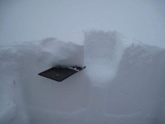
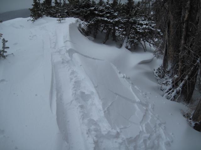
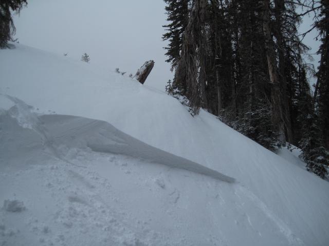
The fresh wind slabs today were breaking on some preserved faceted snow that was on the surface prior to the weekend storm.
Today's Observed Danger Rating
Moderate
Tomorrows Estimated Danger Rating
Considerable