Observation Date
1/7/2018
Observer Name
Catino
Region
Salt Lake » Big Cottonwood Canyon » Silver Fork
Location Name or Route
Upper Silver Fork
Weather
Sky
Clear
Wind Direction
West
Wind Speed
Moderate
Weather Comments
Clear morning with light to moderate winds, fairly pleasant.
Snow Characteristics
New Snow Depth
4"
New Snow Density
Medium
Snow Surface Conditions
Powder
Dense Loose
Snow Characteristics Comments
It's amazing how such a small amount of snow, for Wasatch standards, can improve the conditions significantly. The medium density snow had enough body to not sink into the old tracks where it was smooth. No real wind drifts to speak of on East facing West bowl, but towards the northern tilt I could see one small wind bulb off the ridgeline. Climbing from BCC, at 7800 there was not much snow until you got higher towards the Emma ridgeline and upper LCC.
Red Flags
Red Flags
Recent Avalanches
Poor Snowpack Structure
Red Flags Comments
Saw one new snow natural on the Silver Fork Headwall, seemed to have run on the facets. Not much of a slab, but new snow running on NSF faceted layer.
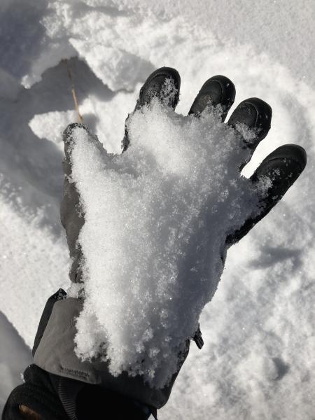
Of note: after climbing up from 7800 where there was not much snow. At 8500 Ft - East facing, in a cold hollow zone near surface facets were still preserved see photo below. Something to keep in mind on shady slopes as we get more snow. At 9500 - near surface facets were still present under the snow but not as large grained as in the cold hollow locations. Also, the water weight seemed to have been sucked out a bit overnight in comparison to yesterday's creamy turns, huge improvement in riding conditions.
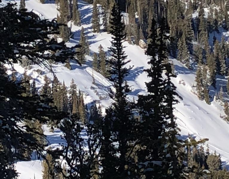
I also noted a slide in East Facing Main Days while atop Hideaway Park, towards the bottom near a break over and small cliff. There were two tracks that skied the slope, but couldn't tell from afar if they triggered it on the down or from the skinner, or if it was natural. The two tracks went past it, so assumed they were fine. See photo below.
Comments
Not enough to tip the scale today where I traveled, but if this week's weather comes in the wheels may finally come off. Definitely possible to wake the dragon on a high north slope that is wind loaded, and also tomorrow's pre storm warm weather may get some mid and lower South and East slopes to slide and perhaps entrain.
Photos below: Preserved NSFs and Slide seen from afar in lower Main Days. If you look closely it almost seems like an older crown extends to the looker's left.
Today's Observed Danger Rating
Moderate
Tomorrows Estimated Danger Rating
Moderate