Observation Date
12/29/2017
Observer Name
B
Region
Salt Lake » Big Cottonwood Canyon » Brighton Perimeter
Location Name or Route
Brighton Perimeter
Weather
Sky
Clear
Wind Direction
Northwest
Wind Speed
Light
Weather Comments
Clear skies in the morning with sparse cloud cover in the pm. Light winds at mid elevations with sustained upper elevation WNW winds that were transporting blowing snow in the Light category. Temperatures were mild and above freezing at mid elevations for more than 12 hours.
Snow Characteristics
Snow Surface Conditions
Powder
Wind Crust
Melt-Freeze Crust
Damp
Snow Characteristics Comments
SE, S and SW aspects continue to get substantial solar radiation and develop m/f crusts. All other aspects have a mix of good settled powder and wind affected surface conditions. Pencil to knife hard Wind Crusts of up to 4 inches thick were observed even at mid elevations.
Red Flags
Red Flags
Recent Avalanches
Cracking
Collapsing
Poor Snowpack Structure
Red Flags Comments
Avalanche activity continues to occur each day, and this combined with collapsing and cracking observed today in the Brighton Perimeter indicates the Poor Snowpack Structure is an issue of concern.
Avalanche Problem #1
Problem
Persistent Weak Layer
Trend
Same
Problem #1 Comments
Buried facets at the interface of the old snow surface prior to all of the new snow from the Christmas storm events appear to be the significant reactive weak layer and player in the majority of the avalanche acitivity. Of note, after speaking with avalanche professionals from upper BCC, and snow pit test appear to confirm this, the sensitivities observed in other locales do not appear to be as reactive in the limited areas near the Brighton Perimeter. All that said, the poor structure is similar and in place in these regions of upper BCC. ECT's and CT's have not been indicating a strong propensity for propagation at mid elevations in the upper BCC over the past two days. And regardless, the limited bridging that may be going on in this isolated area is not enough to instill strong confidence.
Avalanche Problem #2
Problem
Wind Drifted Snow
Trend
Increasing Danger
Problem #2 Comments
The sustained upper elevation winds have been active for the past 48 hours, and upper elevaiton terrain may still be suspect. Mid elevation wind slabs were observed and they were stubborn and unreactive. Saturdays forecast indicates continued "breezy" conditions, and this may keep the potential for isolated pockets of wind slabs possible on slopes on the right side of the compass. These possibilities may increase slightly overnight and into Saturday.
Comments
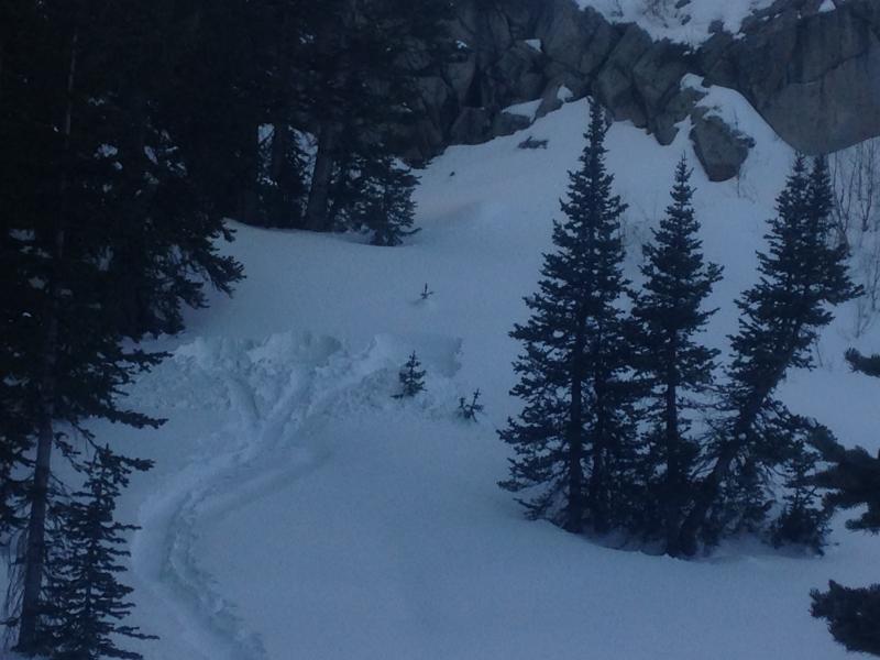
A plea to Avalanche Educators and other recreationalists that are out there digging snow pits. This photo was taken on 12/29 at 1600 hours. It was near Dog Lake in BCC, on the north side of the ridge that ascends to the Dog Lake Chutes, and eventually the north ridge of Pioneer Peak. Obviously, this was the work of an avalanche class in the past two days. Please fill in your snow pits; and if you are an avalanche educator please teach your students to do the same. If you were in this class, please inform your fellow students and the instructor to go out there and take care of this hazard and eyesore.
Today's Observed Danger Rating
Considerable
Tomorrows Estimated Danger Rating
Considerable