Observation Date
12/23/2017
Observer Name
CBrown
Region
Salt Lake » Little Cottonwood Canyon » Alta Periphery
Location Name or Route
Alta Periphery
Weather
Sky
Obscured
Precipitation
Moderate Snowfall
Wind Direction
West
Wind Speed
Moderate
Weather Comments
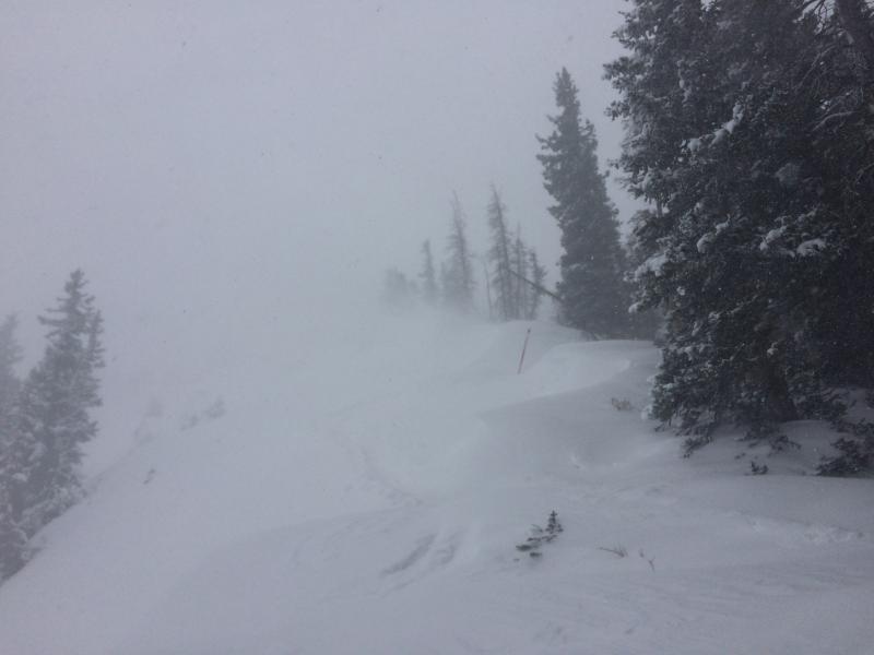
Steady moderate winds with strong gusts, seemed to be increasing in the afternoon. Temps also felt like they dropped in the afternoon, after around 14:00 roughly. Fairly steady snowfall throughout most of the day varying between light and moderate.
Snow Characteristics
New Snow Depth
16"
New Snow Density
Medium
Snow Surface Conditions
Powder
Wind Crust
Snow Characteristics Comments
Seemed a little bit thicker than the storm Wed/Thurs. Between the two storms was seeing about 50-60cm of new snow up at ~10k'. Some places the snow was slightly upside down. Was seeing short periods of graupel in the afternoon, not significant to make a full layer. This storm seemed to be slabbing up a little bit more than I've seen with the minimal other storms we had this season.
Red Flags
Red Flags
Heavy Snowfall
Wind Loading
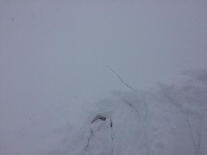
Cracking
Collapsing
Poor Snowpack Structure
Red Flags Comments
Still all that weak snow on the ground below the new snow. I was suprised in my limited travels today to not see any widespread instabilities, but with the visibility and conditions I couldn't see to far and was keeping it conservative due to the implications of a minor incident in the conditions present. With the winds, snow, visiability and the consequences of a small avalanche or injury and the complications of a potential rescue in these conditions, more conservative discision making was warranted. Because of these factors my scope of the day might have been somewhat limited as to the stability. That being said I was seeing storm and wind slab formation, lots of snow available for transport, cracking, collapsing and my prior knowledge of the old weak snowpack.
Avalanche Problem #1
Problem
Wind Drifted Snow
Trend
Increasing Danger
Problem #1 Comments
I was seeing the snow forming into soft wind slabs close to ridge lines with lots of cracking and collapsing, but due to conservative decision making with limited visibility, I was not seeing this to run. Along with the wind slabs, I was also seeing the storm snow cracking and showing signs of slab formation. I would expect these wind slabs to grow and harden with the continued winds. I was skeptical of the old buried wind slabs on a weak snow pack being a problem but did not see any activity of this kind, and did not hear any reports of this activity talking with a number of folks. With my limited view today I would NOT take this as a sign of stability but more of a limited data set and higher uncertainty, lending to conservative decision making and larger margins until more information is gathered.
Avalanche Problem #2
Problem
Persistent Weak Layer
Trend
Increasing Danger
Problem #2 Comments
I think the persistent slab issue may be coming into play with the snow and water totals of this storm as well as the winds loading slopes. I thin we might be close or at the tipping point to activate those PWL's that are lurking under all this new snow. Don't forget what the snow pack was looking like before this storm and travel conservatively until we can see the effects of the storm. If something steps into the PWL's with our shallow and weak snow pack, full depth avalanches with high consequences and lots of trauma are real outcomes. It's not worth tickling the monster.
Comments
Wind Loading at Catherine's Pass
Shooting Cracks
Stay safe while the snow pack adjusts to this new load. We aren't in the same situation we were last year. We have a shallow weak snow pack with lots of rocks just barely hidden under the new coat of paint, don't be fooled.
Today's Observed Danger Rating
Considerable
Tomorrows Estimated Danger Rating
Considerable