Observation Date
12/20/2017
Observer Name
CBrown
Region
Salt Lake » Little Cottonwood Canyon » Alta Periphery
Location Name or Route
Alta Periphery
Weather
Sky
Overcast
Wind Direction
Southwest
Wind Speed
Moderate
Weather Comments
Overcast skies this morning, moderate SSW wind blowing, moving what little snow around that was available for transport. No new snow while in the mountians, seemed to start around 15:00 down in the city. Temps felt pretty moderate before leaving around 13:30.
Snow Characteristics
Snow Surface Conditions
Powder
Faceted Loose
Wind Crust
Melt-Freeze Crust
Snow Characteristics Comments

Quite a wide variety of snow conditions out there. Everything from wind hammered and unsupportable crusts to some nice settled old powder, to loose skiable facets. Did not observe the SH that has been being talked about. The areas where it existed yesterday seemed to have been destroyed by the wind or possibly even the temps. I would suspect that it remains in a few isolated areas that are protected enough from the wind.

Red Flags
Red Flags
Wind Loading
Cracking
Poor Snowpack Structure
Red Flags Comments
The biggest note is still definitely just how weak the snowpack has gotten over the past 1 to 2 weeks. Bottomless facets with some large grain depth hoar on the ground many places on northerlies, mix of crusts and facets on other aspects. I'm sure anyone who has been out has been seeing this, and anyone who hasn't been out has probably heard about it by this point. Some of the mid pack crusts seem to have decomposed to some extent due to faceting, especially on more northerly aspects. The north aspects seem to just be a pack full of facets with some small variences in resistance and size. Things are going to get interesting if we actually put a load on this with this storm. I also did see some wind loading and some new sensitive shallow windslabs that were cracking easily. I would expect this to increase and grow in depth with additional snow.
Avalanche Problem #1
Problem
Wind Drifted Snow
Trend
Increasing Danger
Problem #1 Comments

Saw some wind slabs that had formed since the winds cranked up with what little snow is left around available for transport. Sensitive, yet shallow in specific areas. Would suspect that this will become more of an issue with the new snow.

Avalanche Problem #2
Problem
Persistent Weak Layer
Problem #2 Comments

If we actually get some snow out of this storm I would expect things to go off with the weak top to bottom snow pack that seems to exist pretty much anywhere there is snow. I would expect them to go full depth once initiated, dependent on the new load. Souths are bare in most places.

Comments

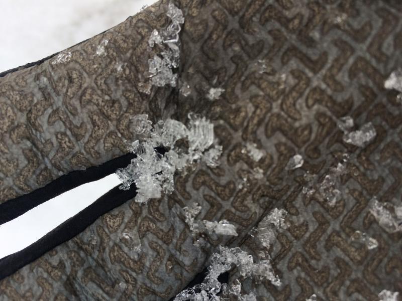
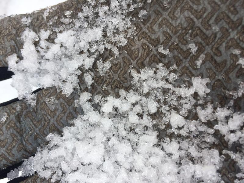
Large, striated cupped depth hoar on the ground at 10,400' N

Faceted graupel mid pack

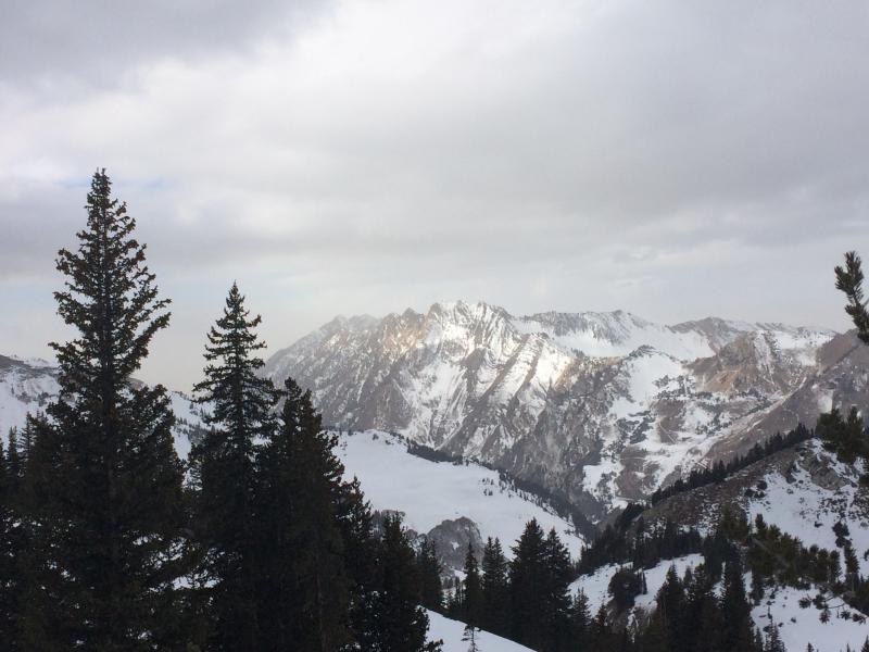
Low tide looking towards the Emma's, Superior, with a blanket of old snow on W Bowl and Cardiac

Today's Observed Danger Rating
Low
Tomorrows Estimated Danger Rating
None