
Observation Date
12/13/2017
Observer Name
Evelyn
Region
Salt Lake
Location Name or Route
Point Supreme/Dry Fork
Comments
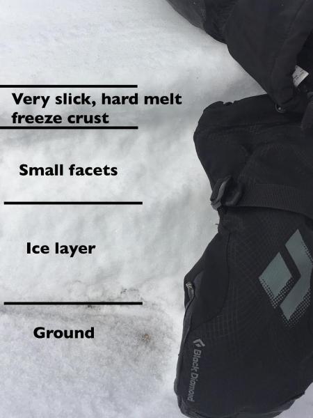
Most of the focus has been on the weak, faceted snow pack on the shady slopes. These are the slopes that will be most dangerous once it snows.
But I figured it was worth a quick look at the other "white" slopes - those sunny slopes still holding snow. This southeast facing, upper elevation slope has a very shallow snow pack - maybe averaging 8 to 12" deep - but deep enough to connect across small ground features. It's capped with a hard, smooth ice layer. I expect once it snows, the new snow will bond poorly to these icy crusts, and the snow will sluff and slide readily. Avalanches will run fast on these crusted slopes, and entrain snow as they move down slope.
Today's Observed Danger Rating
Low
Tomorrows Estimated Danger Rating
Low
Coordinates


