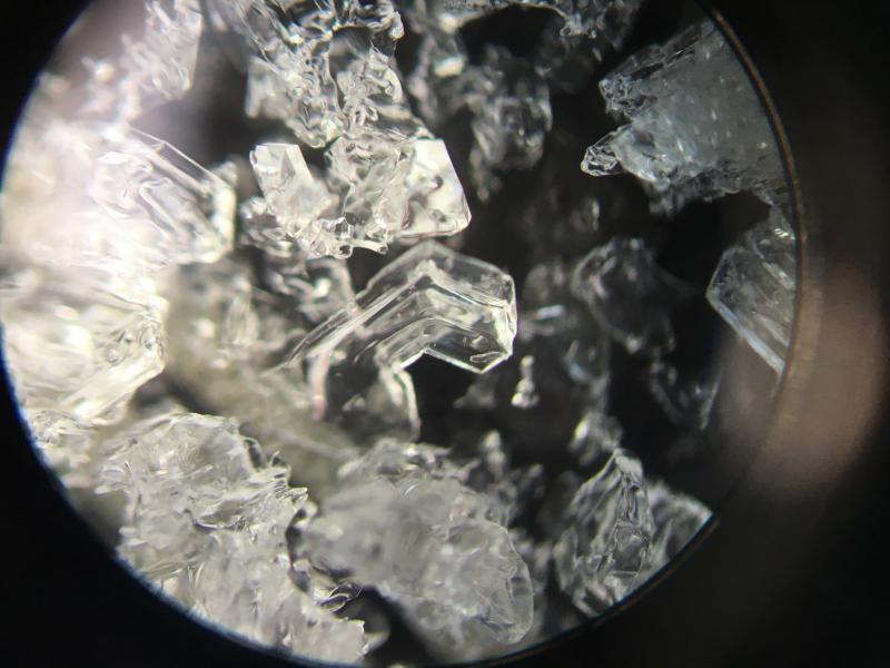
No mystery what's going on - weak snowpack that has shrunk to 30-50 cms (12-20") on upper elevation northerly aspects. Large-grained, striated depth hoar near the ground with facets above that. What I found most interesting is the rain/temperature crust that formed the week of Thanksgiving. On some aspects this crust has almost entirely deteriorated, however there are also places where it was still a few cms thick.
The cm of snow that fell last Monday is now just a few mms of small-grained facets on top of this crust. This thin faceted layer may provide one possible weak layer - with the crust acting as a bed surface.
What may be tricky with this upcoming storm is that where the crust is thicker, it may support a greater load before failing in the faceted snow down near the ground.
We have a very dangerous setup on northeast through northwest aspects above about 9K. Currently Low hazard but things may quickly change with storm snow and wind loading.
Several pits on north and northwest aspects between 9800' and 10,300' - pit walls with snow the consistency of kitty litter would just fall out as you isolated a column.
Photo of striated depth-hoar down near the ground.