Observation Date
12/1/2017
Observer Name
Evelyn
Region
Salt Lake » Big Cottonwood Canyon » Days Fork » Upper Days
Location Name or Route
Alta to Upper Days
Comments
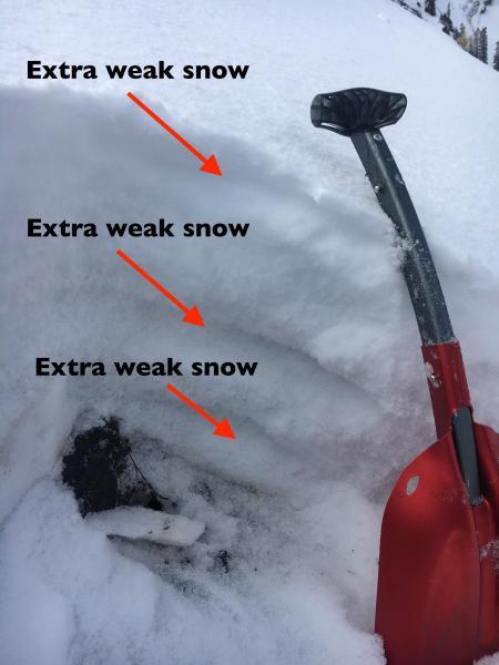
The entire snow pack is weakening, but here there were still 3 distinct extra weak layers. To me, multiple weak layers is a red flag of the possibility of an avalanche stepping down.
Stepping down:
When multiple weak layers exist in the snowpack, often a smaller, shallower avalanche will travel a few feet to a few yards and the added weight and stress will trigger a deeper weak layer, which results in a much larger and more dangerous avalanche.
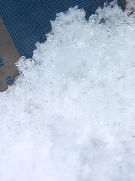
Lower photo - some of the facets.
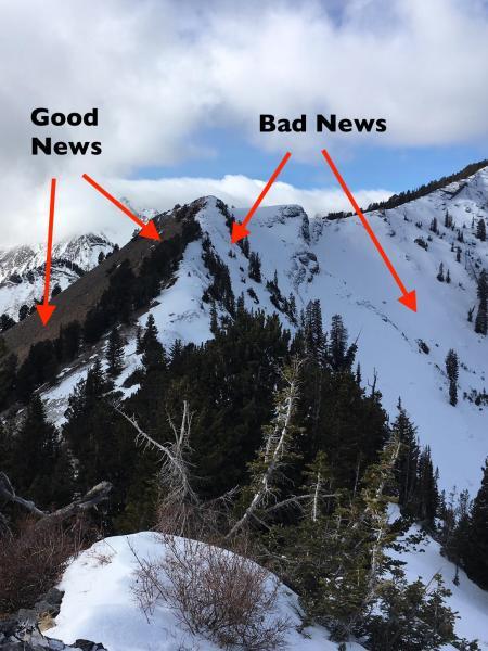
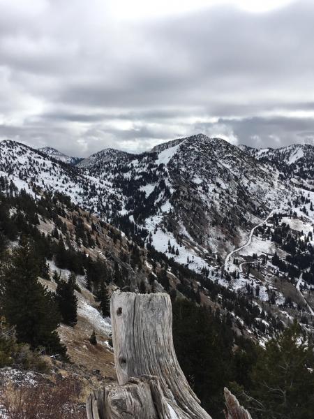
A couple of photos looking into upper Days Fork. Upper photo:
- Bad news is most of the white, snow covered slopes harbor very weak snow, that will be dangerous once it gets more snow on top.
- Good news is that southeast through westerly facing slopes are still bare ground, and have the potential to develop a stronger snowpack once it snow.
- Pro tip: note over what a short distance the snow cover changes from none to weak snow. Once we get snow, it could be just a few steps between safer terrain and very dangerous terrain.
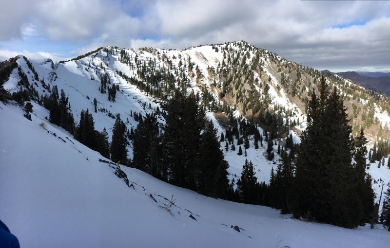
Lower photo is an pano of part of upper Days.
Here is another photo showing snow cover - this is looking toward Grizzly Gulch and Twin Lakes pass.
Today's Observed Danger Rating
Low
Tomorrows Estimated Danger Rating
Low
Coordinates


