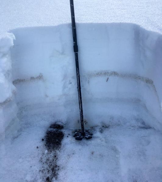
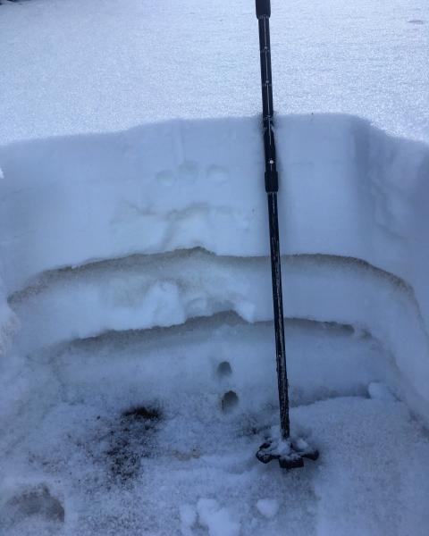
A quick snow pit at 10,100ft on a north facing shady protected slope under Baldy answered any questions that were in my mind about the warm temperatures and lack of a hard freeze stabilizing the buried facets underlying the last storm on high north. A quick and simple answer would be NO. the surface is damp and the new snow from our last storm has settled out to about 10 inches of fairly dense 3 finger snow, the slab. below that is the graupel layer that was not as sensitive as it was right after the storm, the weak layer is the facets under the graupel and on top of the 1 finger hard, slick and frozen old September snow, the bed surface. I could not isolate a column in any of my snow pits they would all fail upon isolation in the facets resting on the hard bed surface. It doesn't take a avalanche expert to figure out whats up when your column pops out like a cash register drawer upon isolation. These high norths will certainly be suspect when we receive a new load. The lower elevations and off aspects have improved with the warm temps and will be a better bet when we do receive a new load.
Photos: Snow pit, and a video that basically says it all.