Observation Date
11/18/2017
Observer Name
Tyler Falk
Region
Salt Lake » Little Cottonwood Canyon » Grizzly Gulch » Twin Lakes Pass
Location Name or Route
Twin Lakes Pass
Weather
Sky
Clear
Wind Direction
West
Wind Speed
Light
Weather Comments
Calm and clear after the splitting strom. Valley temps were around 30 this morning, 24 at the powerplant and by the time I got to Alta the temp dropped to 10 degrees at 7:15am. Not much wind on 10k ridgelines and below.
Snow Characteristics
New Snow Depth
14"
New Snow Density
Medium
Snow Surface Conditions
Powder
Dense Loose
Snow Characteristics Comments

Alta collins showing 1.81" of water with 14" of snow. (15%) Heigh of snow on the ground varried up to about 80cm. Storm snow was mostly right side up. Grapuel noticed on the snow surface and at the start of the storm snow. Areas with old snow were identifiable with a ski pole. I could not easily make a snowball with the grains in the lower part of the pack. Dried out retivily quick thanks to come cold temps.

Red Flags
Red Flags
Collapsing
Poor Snowpack Structure
Red Flags Comments
A few small collapses noticed breaking trail on the ridge between twin lakes pass and Patsy when tickeing the ridgeline a bit. In places where there is old snow there is a poor snowpack structure.
Avalanche Problem #1
Problem
Persistent Weak Layer
Trend
Same
Problem #1 Comments

Weak snow which lingered from earlier in the fall is the primary concern. Avoidance is key as these slides would be nasty rides with such a thin snowpack. Areas which look smoother and more filled in on the North side of the compas are suspect.

Avalanche Problem #2
Problem
Wind Drifted Snow
Trend
Decreasing Danger
Problem #2 Comments

Strong winds which transported snow durring the storm yestarday created some windslabs up high.

Comments

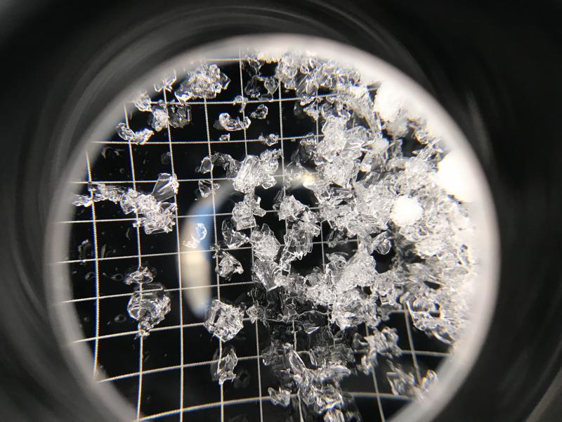
Pic 1. Squares on 3mm gird. 10,100 NE Aspect

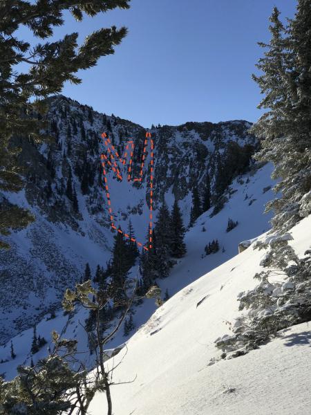
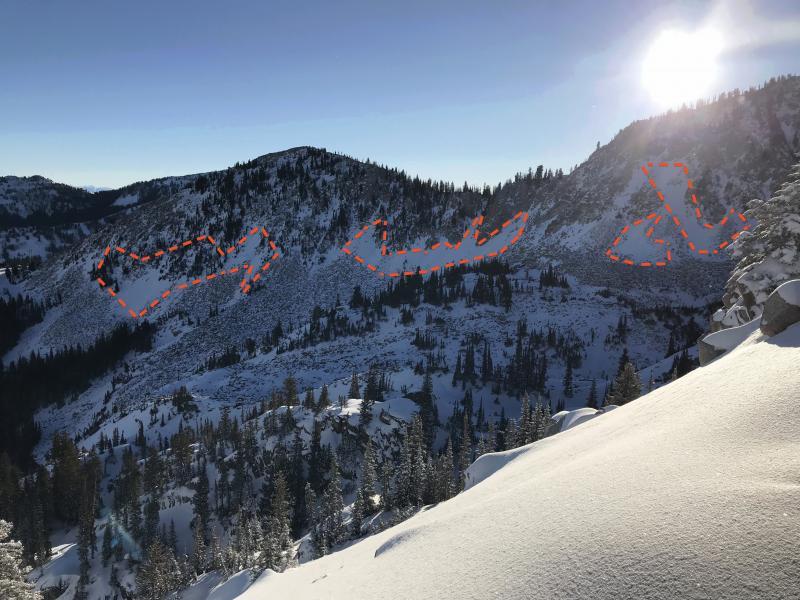
Pic. 2 & 3. Distribution of old snow in red.

Today's Observed Danger Rating
Moderate
Tomorrows Estimated Danger Rating
Moderate