Planned Website Outage: The UAC website will be down for maintenance on June 17 from 2:00 - 7:00 PM MT.

Observation Date
4/26/2017
Observer Name
Hardesty
Region
Salt Lake » Little Cottonwood Canyon » Alta Periphery
Location Name or Route
Rocky Point/Tuscarora/Wolverine/Patsy Marley
Weather
Sky
Overcast
Precipitation
Light Snowfall
Wind Direction
Southwest
Wind Speed
Light
Weather Comments
Overcast and warm. Freezing level exceeded 9500'. Greenhousing affected snow quality.
Snow Characteristics
New Snow Depth
16"
New Snow Density
High
Snow Surface Conditions
Powder
Melt-Freeze Crust
Damp
Snow Characteristics Comments

Settled storm snow from Monday/Tuesday to about 40-50cm at the mid and upper elevations. Cascade cement. Northwest winds had scoured a few upper elevation northwest starting zones down to the old mf crust. Steenburgh has a good write-up on greenhousing here.


Anticipate the new snow bonding well with the current snow surfaces and will keep an eye on wind and precipitation intensity for tomorrow.

Red Flags
Red Flags
Rapid Warming
Poor Snowpack Structure
Red Flags Comments
Greenish/yellow flags? Bits of sun, warming and greenhousing promoted detereoration of snow surfaces at least to 9500' on north leading to small damp rollerballs and pushalanches...all size .5 or less. 1mm heavily rimed snowflakes/arguably graupel remains at interface of old crusts.
Comments

Quite the size 2+ avalanche cycle yesterday in the upper Cottonwoods. Seems to have rapidly settled out for today. Snow profiles on many aspects at the mid and upper elevations similar in structure: photo below. Roughly 30-50cm of settled storm snow above the old melt freeze crusts. ECTN and CT in the upper 20s. Only stepping above an old crown near Twin Lakes could I get a crack to propagate even 5' ahead of my skis.

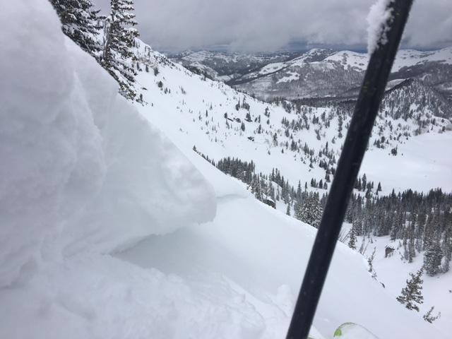
Rapid warming producing "creep" within the upper portions of the storm snow. Note how much the slab has crept over the old fracture line. Fracture lines are perpendicular upon release and this crown is perhaps 24-28 hours old. I wrote a paper on an avalanche cycle from March 2012 stemming from solar radiation and heating...though those were very different conditions.

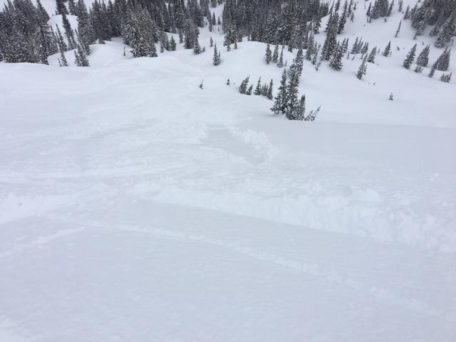
Photo of minor push-a-lanche into northeast facing terrain above twin lakes. Much dependent on even a brief window of sun to enhance the already warm and greenhousing temps.

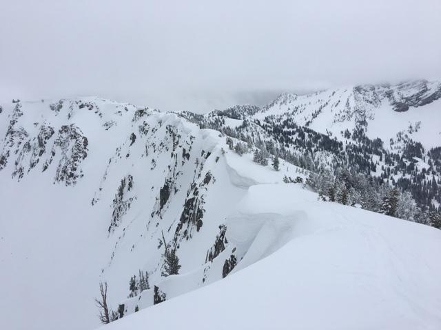
Obligatory calendar shot of the cornices lining Wolverine.

Today's Observed Danger Rating
None
Tomorrows Estimated Danger Rating
None