Early morning tour into Cardiff/Cardiac. Thought I would need to get an early start to avoid warming from the sun, but cool temperatures and winds kept the snow surface cool on all aspects.
Biggest surprise was the persistent SE/E winds that grew increasingly strong throughout the morning. By late morning, winds were reaching well down off ridge lines and channeling through terrain features. Biggest drifts I found were 30 cm (12") pockets, but they were not sensitive to any quick stability tests. I also suspect much of the wind-blown snow was sublimating and not being deposited. But fresh drifts are possible on all aspects at the upper elevations, and something to keep in mind for those getting out on Sunday morning. Video below shows wind drifting at 10,500'
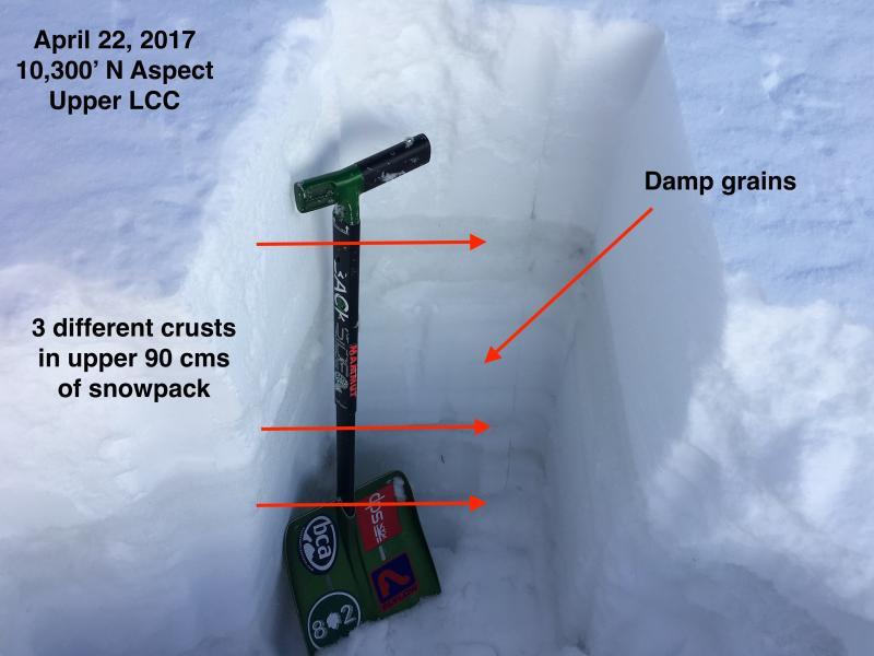
Also have been looking at the northerly aspects in the upper elevations. Over the past month we have had a few M/F crusts form in the upper 90 cms of the snowpack. The snow surface prior to the Thursday night storm had frozen solidly and is 5-10 cms (2-4") thick, with damp grains underneath. At least two other M/F crusts are below that, with a layer of graupel from 3/22 storm sitting on top of one of the crusts. I'm always intrigued at the possibility of wet slab activity on upper elevation north aspects, and these crusts may inhibit the flow of meltwater once these aspects undergo warming. (Mark has a great demonstration of this with his Tang test.)
Not an issue for now, and this coming week is looking wet and unsettled, with no major warming in sight.