Observation Date
4/21/2017
Observer Name
Mark Staples
Region
Salt Lake » Little Cottonwood Canyon » Red Pine
Location Name or Route
Red Pine, White Baldy, No Name Baldy
Weather
Sky
Overcast
Weather Comments
W and NW winds had moved some snow above 10k feet. Sun peeked out occasionally today but clouds and cool temps kept conditions good. I was surprised that the new snow didn't get too wet. Skiing back to the White Pine trailhead was great.
Snow Characteristics
New Snow Depth
6"
Snow Surface Conditions
Powder
Red Flags Avalanche Problem #1
Problem
Wind Drifted Snow
Problem #1 Comments
Snow would break about 2 to 4 inches deep within the storm snow. Not a stability issue unless there was wind deposited snow. Booting up the NW face of White Baldy we closely watched for isolated wind drifts. Fortunately winds had blown straight up the face, somehow leaving good powder and scouring only the top 100 ft.
These will bond quickly but could make wet slab avalanches tomorrow.
Avalanche Problem #2
Problem
Wet Snow
Trend
Increasing Danger
Problem #2 Comments
Very few roller balls seen today. It will be a different story tomorrow (Saturday).
Comments
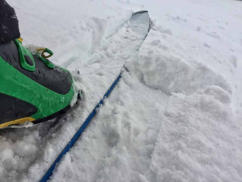
First photo: layer within storm snow that would break but produced zero shooting cracks or signs that it was unstable.
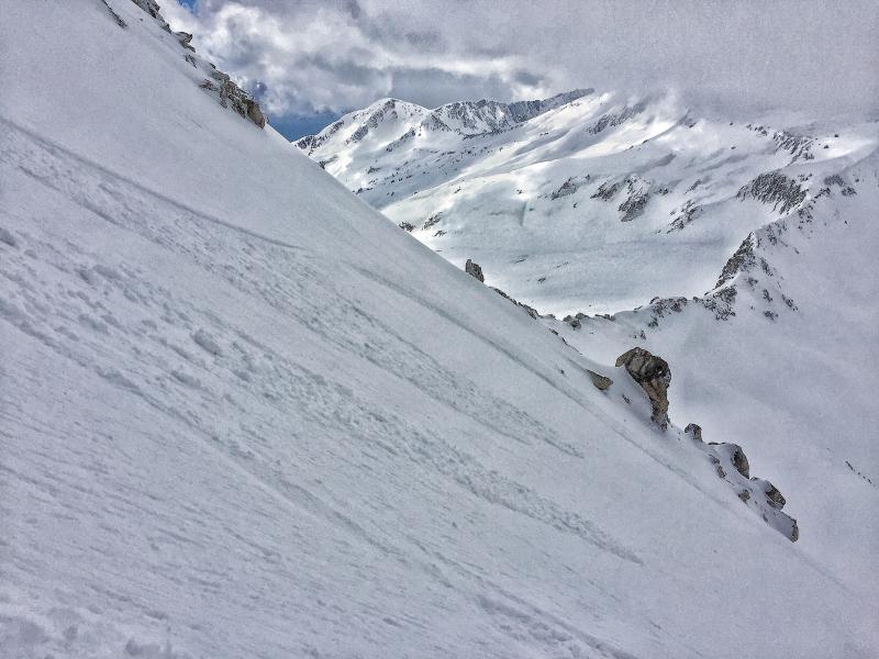
Second photo: layer would break under each turn and move just a little snow downhill a short distance.
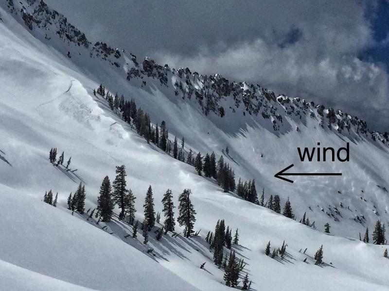
Third photo: a wind slab we triggered intentionally. It was surprisingly sensitive. The second pocket broke at the same time.
Video
Today's Observed Danger Rating
None
Tomorrows Estimated Danger Rating
None
Coordinates