Planned Website Outage: The UAC website will be down for maintenance on June 17 from 2:00 - 7:00 PM MT.

Observation: Park City Ridgeline

Observation Date
4/5/2017
Observer Name
B
Region
Salt Lake » Park City Ridgeline
Location Name or Route
Park City Ridgeline
Weather
Sky
Scattered
Wind Direction
Southwest
Wind Speed
Light
Weather Comments
Light steady SW winds on the ridgelines, with no wind blown observed. Temperatures in the teens through the early morning hours and then by mid day things warmed up to normal seasonal figures. The cloud cover thickened in the mid morning hours to help keep these temperatures under control.
Snow Characteristics
Snow Surface Conditions
Dense Loose
Faceted Loose
Wind Crust
Melt-Freeze Crust
Damp
Snow Characteristics Comments

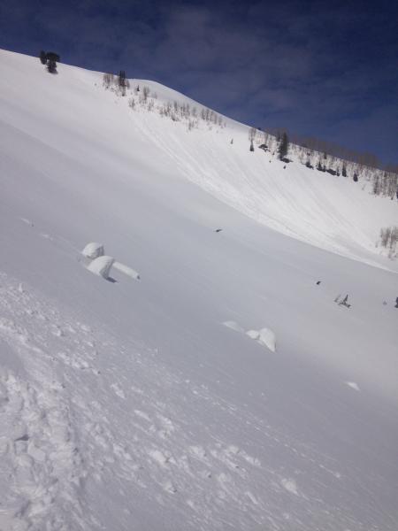
Variable conditions out there. Still able to find 3 inches Dense, Faceted, Loose, cold snow above 9600 and these turns were short lived but fun. In areas where the winds had not damaged this north facing old powder it appears that there is potential for longer runs in higher elevation terrain. Regardless, the winds have definitely been active over the past few days, and stubborn/unreactive winds slabs of up to 4 inches thick were also observed.

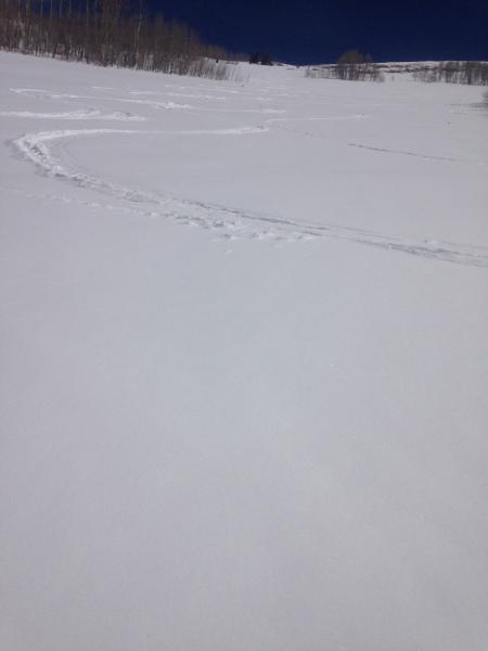
The best riding was on supportable/softening surfaces on ESE, S and SW aspects all the way up to the ridgeline. Very good corn-like conditions were found everywhere except in locations where folks failed to follow the simple corn riding rules: "Ride it and move on, and leave no trace". ESE aspects did not soften until 1100 and SW was perfect as late as 1400.

Conditions on the northerly aspect were very similar to those reported by Hardesty on the 4th in his Tri-Canyon observation. The surface snow has faceted on the upper elevation northerly facing slopes, and this layer (2 to 4 inches deep) is resting on a friable melt/freeze crust that is 2 inches thick. Below this layer there is another layer of facets that is between 4 and 5 inches deep. The unseasonably cold overnight temperatures for the past three evenings have driven this process like it was mid winter. These past few days of cold weather appear to have helped turnaround the damage driven by the successive weeks of warm temperatures in mid March. It appears that the snowpack above 8000 feet no longer has buried damp layers.

Red Flags
Red Flags
Recent Avalanches
Poor Snowpack Structure
Red Flags Comments
See Wet Loose activity photo from South Monitor (SE) that appeared to have run on 4/3; and the picture does not detail the 5 foot depth of this debris. Poor Snowpack structure on the upper elevation northly aspects is detailed above, and it will need to be considered in this isolated zone once we see how the forecast for this coming weekends loads develop.
Avalanche Problem #1
Problem
New Snow
Trend
Decreasing Danger
Problem #1 Comments

Very minimal Loose Dry Snow sluffing was observed on isolated steep northerly facing terrain at the upper elevations.

Avalanche Problem #2
Problem
Wet Snow
Trend
Increasing Danger
Problem #2 Comments

Tuesdays and Wednesdays cool temperatures produced limited Wet Loose Snow Avalanches. Yet, with the forecast slated to drive the daytime highs at least 15 degrees higher (and into the 50's at 9000) for Thursday and Friday, more Wet Loose activity may be an issue on WNW, N and ENE aspects. Even shady and heavily treed aspects at upper and mid elevations are not yet cooked down, and these places may also be locations where Wet activity may be possible.

Wednesdays Danger appeared to be Low. And, this Danger rating should elevate to Moderate with the rapid warming in the forecast.

Loose Wet Activity on SE facing South Monitor with significant debris pile.

Poor Corn riding etiquette.

Today's Observed Danger Rating
Low
Tomorrows Estimated Danger Rating
Moderate