Observation Date
3/31/2017
Observer Name
Evelyn
Region
Salt Lake » Little Cottonwood Canyon » Alta Periphery
Location Name or Route
Dry Fork, Rocky Point, Wolverine, Patsey Marley
Weather
Sky
Overcast
Precipitation
Light Snowfall
Wind Direction
Southeast
Wind Speed
Calm
Weather Comments
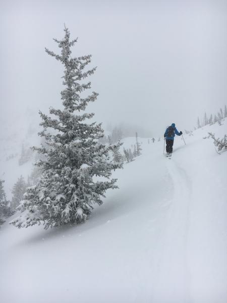
Winds mostly calm, a very light breeze at times and very warm temperature. Most of the time, we were sandwiched in between a thick fog bank below and overcast skies above. Very light snow during the morning, with no real accumulation. The sun came out for about 30 minutes around 12:30.
Snow Characteristics
New Snow Depth
7"
New Snow Density
High
Snow Surface Conditions
Powder
Snow Characteristics Comments
Good dense snow until the sun came out for 30 minutes, and it went to mashed potatoes on all aspects instantly. "Shady" slopes included in this heating due to "green housing" because there were thin, diffuse clouds. You know it's over when your partner from the northwest says "wow, this is getting really thick". Out of the backcountry by 1:30, we could have been even earlier. Tomorrow, I would expect breakable crusts on just about all aspects/elevations in the morning, with a quick return to mashed potatoes with sun and heating during the day.
Red Flags
Red Flags
Rapid Warming
Red Flags Comments
It only took 30 minutes of sun to destabalize the new snow, making wet loose sluffs easy to trigger. Change happens so fast this time of year.
Avalanche Problem #1
Problem
Wet Snow
Problem #1 Comments
Roller balls and wet loose sluffs were easy to trigger when we exited. The plus of today's heat/sun event is it is helping to settle the snow on all aspects and it will be less sensitive yesterday. However, I would still expect wet loose sluffs of all the newest snow tomorrow with the clear skies, warm temperatures and direct sun in the forecast.
Avalanche Problem #2
Problem
Wind Drifted Snow
Problem #2 Comments
I was surprised at the lack of wind today. Along the highest ridge lines, a few small, cracky soft wind drifts, but not propagating, and becoming less sensitive as the day went on. With the dense snow and widespread crusts, stronger winds will be needed tomorrow to drift any snow, and I'm not sure if we'll get those wind speeds.
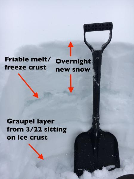
Snow Profile
Aspect
Southeast
Elevation
10,300'
Comments
Quick pit below in upper Dry Fork, SE facing, 10,300', looking at the upper snow pack. Weakest layering is the friable crust the overnight snow is sitting on. However, all the snow is so warm, I'd expect bonding and strengthening to continue.
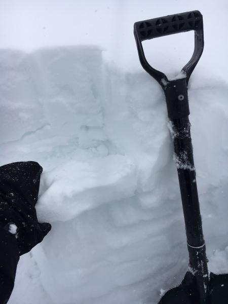
Lower photo is of the crust.
On northerly facing slopes on the exit, the same general feeling of a very warm upper snow pack, with a general trend of settlement and bonding, though this was below 10,500'.
Classic Northwest day - warm, damp, dense snow, and poor visibility much of the day.
Today's Observed Danger Rating
Moderate
Tomorrows Estimated Danger Rating
Moderate