Low hazard this afternoon, although I wouldn't be surprised if there was some small wet, loose activity below 9000' due to rain-on-snow.
The trace-2 cms new has bonded well to old snow surface, and new snow is damp, so any snow that comes in overnight should continue to bond well. If we get the low end of forecasted amounts (3-5") some loose avalanches possible on Friday. If we exceed the high end, watch for drifting in the upper elevations and in unusual places, due to forecasted easterly winds.
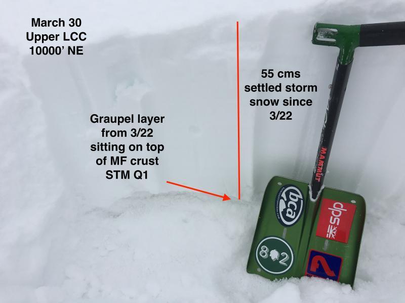
Starting to think more about the north aspects as they will undergo warming as we enter April. Dug a pit at 10,000' on a NE aspect. 55 cms (22") storm snow since Wed 3/22. The snow that fell on 3/22 was a graupel layer, and it is sitting on top of a melt-freeze crust. Was able to get easy to moderate shears, at either Q1 or Q2 failing at this graupel layer. Not a concern for now, but am watching the structure of the snowpack on upper elevation (> 10000') aspects as we enter April and expect warming at the upper elevation shady aspects.
Ty Falk has a super nice observation from Tuesday where he is also noticing this graupel layer in upper elevations in Cardiff Fork.