Planned Website Outage: The UAC website will be down for maintenance on June 17 from 2:00 - 7:00 PM MT.

Observation: Monitors

Observation Date
3/28/2017
Observer Name
mark white
Region
Salt Lake » Park City Ridgeline » Monitors
Location Name or Route
Monitors
Weather
Sky
Broken
Wind Direction
North
Wind Speed
Moderate
Weather Comments
Broken skies and fairly cold in the AM, breaks of sun and continued wind from the N in the PM, greenhousing, sun and a due N wind not treating the surface snow very nicely.
Snow Characteristics
New Snow Depth
9"
New Snow Density
Low
Snow Surface Conditions
Powder
Wind Crust
Damp
Snow Characteristics Comments

Powder in the wind sheltered N facing terrain, wind crust in the wind exposed terrain, damp on all aspects in the PM. All off aspects will have a crust in the AM, same with any aspect below 10,000ft, and the N facing above 10'000ft is likely to have wind slab or wind crust.

Comments

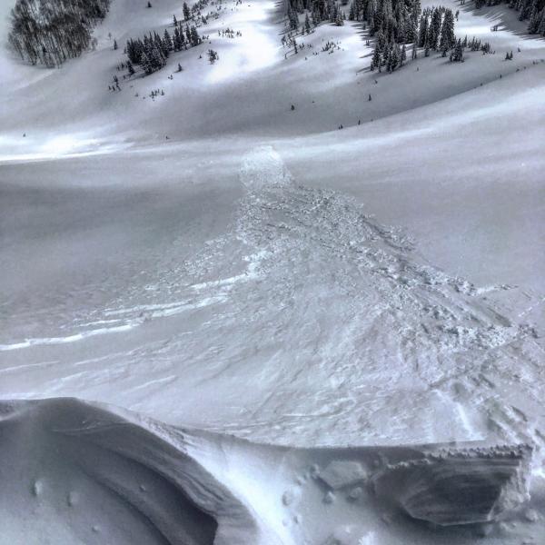
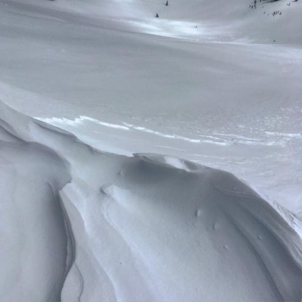
Skied both W and S Monitor today, they had about 9 to 10 inches of new light density snow from yesterday resting on a non frozen and pliable crust. The only activity noted was shallow wind slabs right off the top of the ridge that would run quite a distance but packed little punch. The S facing was damp by 12:00AM and all other aspects, even the due north were becoming damp by 1:30pm. The moderate strength winds from due N combined with the heating of the surface snow does not bode well for good skiing tomorrow, there might be a small window, but if the clouds stick around tonight limiting the drying out of the snow pack. and the wind continues to blow from the N in the moderate category, might be slim pickings tomorrow.

Photo: shallow wind slab in W Monitor.

Today's Observed Danger Rating
Moderate
Tomorrows Estimated Danger Rating
Moderate