Observation Date
3/27/2017
Observer Name
C Brown
Region
Salt Lake » Little Cottonwood Canyon » Cardiff Pass
Location Name or Route
Cardiff Pass
Weather
Sky
Obscured
Precipitation
Moderate Snowfall
Wind Direction
Northwest
Wind Speed
Calm
Weather Comments
Very bad vis, moderate snow fall, almost no wind at the pass. Pretty wet and pretty warm, mid 20's. Temp at Alta town was right around freezing. Winds were not as forecasted.
Snow Characteristics
New Snow Depth
10"
New Snow Density
Medium
Snow Surface Conditions
Powder
Snow Characteristics Comments
About 8-10" new snow, medium density forming into a storm slab around 9500'. Density change in snow about 3-4" down. Hitting the scratchy bottom on all but pretty low angle terrain on the south side. The snow seemed to fall straight down with very little wind observed around 10,000'.
Red Flags
Red Flags
Heavy Snowfall
Cracking
Red Flags Comments
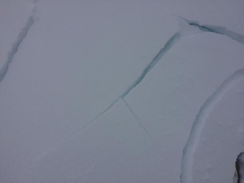
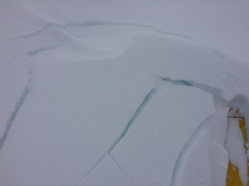
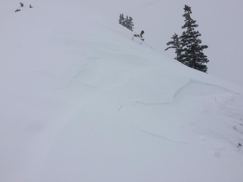
Just barely forming into a very soft stom slab approaching the pass. Had some small senistive soft slabs collapase and crack on 35~40* test slopes but not really move anywhere. Remote trigger of a little pocket on the NE aspect climbing off the pass, about 10" deep.
Avalanche Problem #1
Problem
New Snow
Trend
Increasing Danger
Problem #1 Comments
Soft storm slab's forming in upper elevation terrain. The winds were very well behaved but the snowfall rate was forming a storm slab that was sensitive and somewhat connected. I assume this will settle out very quickly after the storm, but will continue to build until then and become more sensitive. Things seemed pretty well behaved, but if the winds pick up wind slabs will form quickly.
Comments
If the winds pick up to what the forecast says I think there will be some pretty sensitive wind slabs tomorrow morning. I would think a moderate hazard tomorrow with pockets of considerable depending what the winds do and how much more snow we get.
Pictures of cracking pocket of the storm slab, and third picture of remote trigger pocket, triggered from 20-30' away.
Today's Observed Danger Rating
Moderate
Tomorrows Estimated Danger Rating
Moderate