Dug a pit on northwest facing slope, at 10,125'. I was expecting up to a foot of damp to wet snow, and maybe the dust layer beneath, then dry snow...nope. Way more interesting. Reminds me why I need to get out my shovel and dig or I won' t really know what's beneath my feet. There was a bit of variation in the layers just across the short distance of the snow pit wall, which to me means you may need to dig in a few spots to find the weakest and most concerning snow. I'm also wondering if there can be more spacial variation in wet snow than dry.
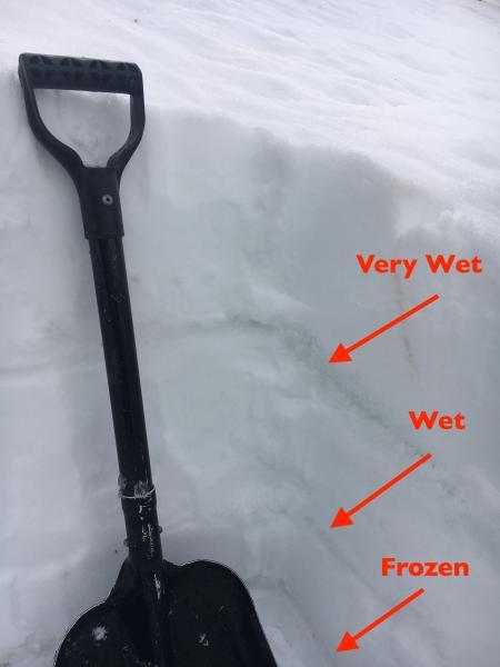
I dug down from the surface to just below the frozen third crust, where the snow become drier and was pencil hardness. The snow was moist from the surface all the way down to this third crust/layer, with two wet layers.
The upper wet layer was the weakest, "Very Wet" with free water, and it's a bit spooky to know that's what's beneath the supportable "corn". After seeing this, we avoided skiing the steepest slopes and roll overs on the way down.
Lower photo is a close up of the weak upper wet layer, dug out a bit.

The snow on the south to southwest facing slopes is really taking a hit along the ridge lines. The snow pack in that terrain is generally shallow to start with due to wind erosion, and now the warm temperatures and sun have melted it down to dirt.
Lower photo is looking over at Claytons - you can see where the snow sluffed earlier, down to the thin dust layer.


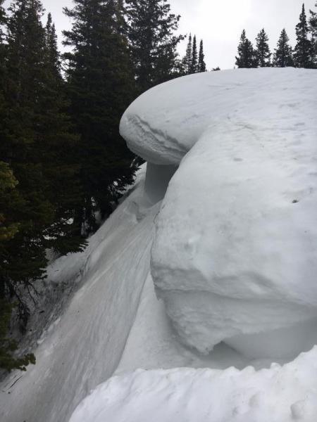
As always, a cornice shot or two. The upper cornice was at about 9,500', and water was dripping steadily off the upper face in several places.