Observation Date
3/7/2017
Observer Name
Toddeo
Region
Southwest » Pahvant Range » Maple Hollow
Location Name or Route
Pahavants - Maple Hollow
Weather
Sky
Broken
Wind Direction
Southwest
Wind Speed
Light
Weather Comments
Some wind above 8,500, some loading and transport above 9,000'.
Snow Characteristics
Snow Surface Conditions
Dense Loose
Faceted Loose
Wind Crust
Rain-Rime Crust
Damp
Snow Characteristics Comments
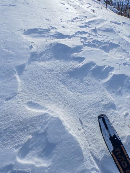
Mixed bag in my travels from 6,700' to 9,100. Wind exposed areas were scoured and loaded. Many of the cornices I dropped yesterday were reformed. Yesterdays skin track was blown in or away.
Still finding settled snow in wind protected areas ranging from settled powder to weakening snow over a crust.
Low elevation areas are damp and/or crusty depending on exposure.
Red Flags
Red Flags
Wind Loading
Rapid Warming
Red Flags Comments
I walked through a lot of wind loaded areas today without any reaction or red flags in wind slabs. Only some limited minor, non-shooting cracks.
Low elevation areas got warm enough to be of concern on solar aspects.
Avalanche Problem #1
Problem
Wind Drifted Snow
Trend
Same
Problem #1 Comments
Although I did not see any real red flags I still adjusted my route to avoid steep wind loaded areas and did not follow my normal route.
Moderate hazard below 9,000', I would imagine more loading occurred at higher elevations.
Avalanche Problem #2
Problem
Wet Snow
Trend
Increasing Danger
Problem #2 Comments
Wet slabs will be a possibility with increasing temps.
Snow Profile
Aspect
North
Elevation
9,000'
Slope Angle
25°
Comments
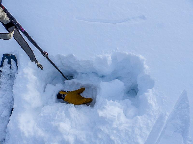
22" of snow above the rain crust. ECTP 5, Q3 5" below the surface, this is a wind slab in the upper snow pack. Glove is sitting on failure surface, decomposing storm particles
Photo below:
ECTN at 8,500' same aspect. Column broke apart.
Photo below: Mixed travel conditions, easy trail breaking. Last weeks skin track visible in photo, this was a trench last week. 8,200' NW aspect on a ridge.
Today's Observed Danger Rating
Moderate
Tomorrows Estimated Danger Rating
Moderate


