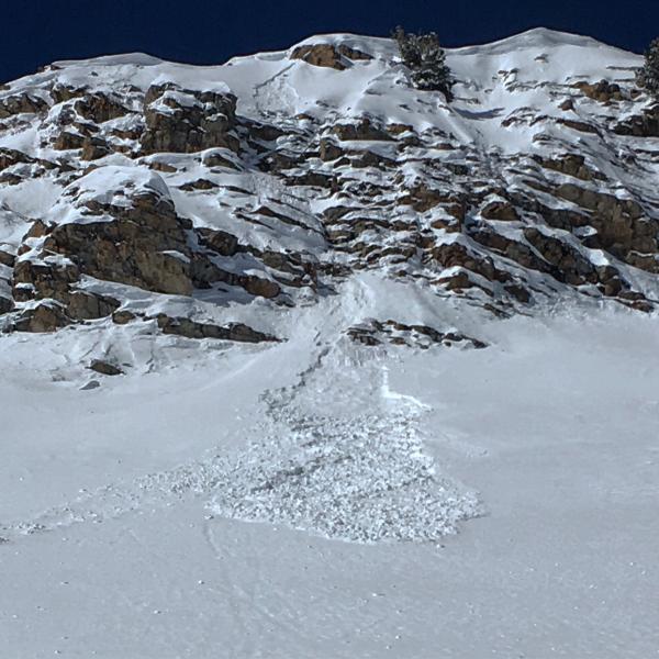
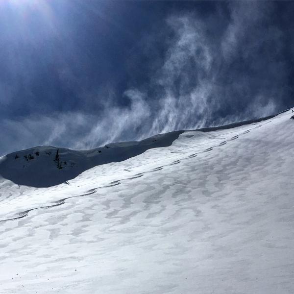
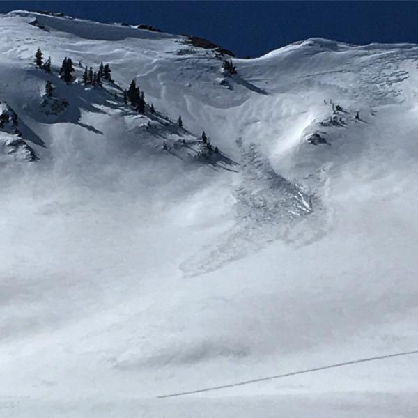
Todays route was the Alta Guard up to LSB NE facing then on to Cardiac Ridge with a exit out Ivory Flakes. The continued wind from last night had stiffened up the surface snow but it still was boot deep and creamy. Didn't see a whole lot of avalanche activity from Sunday and Mondays storm but there was one wind slab on Cardiac Ridge that looked to have pulled out yesterday sometime. Wind slabs were more prevalent at the bottoms of the slopes than at the tops, caused by wind channeling around terrain features on the lower portions of the slopes. I stomped on some pretty hard wind slabs in the top of LSB and Cardiac Ridge and was able to get them to crack but they were stubborn and did not want to move. The wind from the SW continued to move snow on the high ridge line and there might be a few sensitive wind slabs in the AM but this time of year they tend to settle out rapidly with the warming of the day. The surface snow was too stiff to allow any sluffing and I think the main hazard tomorrow will be wet activity with daytime heating if it decides to get warm tomorrow.
Photos: the only wet activity noted today on SE facing Cardiac Ridge, Wind still moving some snow on the high ridge line, and the wind slab that pulled out probably yesterday.