Planned Website Outage: The UAC website will be down for maintenance on June 17 from 2:00 - 7:00 PM MT.

Observation: Snowbird periphery

Observation Date
3/1/2017
Observer Name
B
Region
Salt Lake » Little Cottonwood Canyon » Snowbird periphery
Location Name or Route
Snowbird Periphery
Weather
Sky
Overcast
Precipitation
Light Snowfall
Wind Direction
Northwest
Wind Speed
Light
Weather Comments
Cloud cover vacliated during the day from few to overcast depending on whether there were low clouds and intermittent S minus 1 precip. Winds remained mostly light after 1000 hours at the 10000 feet ridge line level. Transport was occuring and was mostly light. Temperatures in the morning hours were still cold/lower teens, yet daytime heating from the intense early March sun was observed. Winds appeared to be predominently WNW, though there appeared to periods of WSW and spiralling winds in the late morning hours.
Snow Characteristics
New Snow Depth
2"
New Snow Density
Low
Snow Surface Conditions
Dense Loose
Wind Crust
Melt-Freeze Crust
Damp
Snow Characteristics Comments

SSE, S and SW aspects picked up enough solar to get damp, though the heavy density of the snow due to the wind packing prevented it from taking on enough warmth, and as a result the roller ball activity was reduced to a miniumum at the upper elevations. M/F crusts will be in place on Thursday with depths of 2 cm to a zipper depending upon aspect. It appeared that SSW took the biggest hit. At mid to lower elevations the warmth and sun played a much bigger part in creating widespread Wet Loose activity and roller balls.

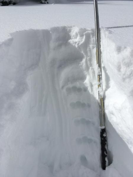
Overall the winds have reeked havoc in the upper alpine on NW, W and WSW aspects. Both upslope and cross slope wind packing and loading created various thicknesses of wind crust, sastrugi and sculpting. Out of the wind affected areas, the snow has definitely settled significantly and become more more dense over the past 48 hours. Regardless, in unaffected areas in the upper alpine the riding is still very good on dense settled powder. The best and least dense powder appeared to be at mid elevations on the upper half of the compass. Fortunately the east aspect appeared to survive due to early morning cloud cover and cold temperatures.

Red Flags
Red Flags
Recent Avalanches
Wind Loading
Cracking
Rapid Warming
Red Flags Comments
Daytime temperatures combined with the intense solar was enough to register moderate warming and wet issues. WNW winds in the upper alpine finally appeared to calm down by mid morning, but they have been active and loading for the past 48 hours. See natural avalanche report in other avalanche observation.
Avalanche Problem #1
Problem
Wind Drifted Snow
Trend
Decreasing Danger
Problem #1 Comments

Lingering wind slabs from less than 8 hours ago appeared to be the predominant issue and problem of the day. Small cross loaded slabs were observed with minimal cracking and insignificant movement on WSW aspects in the upper alpine. See natural activity reported in avalanche report, and there were likely other occurrences in similar terrain. These slabs should become less reactive over the next 24 to 48 hours, yet with the way the wind slab released on the old snow surface, there may be some NSF's that were buried prior to the latest event in isolated locations.

Avalanche Problem #2
Problem
Wet Snow
Trend
Increasing Danger
Problem #2 Comments

Minimal Wet Loose activity in the upper alpine on Wednesday most likely will become more active on Thursday with the daytime temperatures forecast to rise at least another 10 to 15 degrees.

Large overhanging Cornice continue to be of concern and with the warming forecast for the next few days they may become more sensitive.

Particularly of note: Roof Avalanches are likely over the next 24 to 48 hours, and their large size (including thick ice) could be life threatening in the worst case scenarios.

Overall the structure looks good as represented in this hand shear with hand hardness illustrations.

Today's Observed Danger Rating
Moderate
Tomorrows Estimated Danger Rating
Moderate