Planned Website Outage: The UAC website will be down for maintenance on June 17 from 2:00 - 7:00 PM MT.

Observation: Hogum

Observation Date
2/28/2017
Observer Name
Tyler Falk
Region
Salt Lake » Little Cottonwood Canyon » Hogum
Location Name or Route
Hogum Fork
Weather
Sky
Obscured
Precipitation
Light Snowfall
Wind Direction
West
Wind Speed
Light
Weather Comments
Obscured skys in the alpine this morning gave way to broken cloud cover this afternoon in the lower elevations. Stong winds in exposed mid elevation locations and 10k ridgelines. Winds were moving snow from the west below the treeline in some areas. Cold temperatures continued as high temps at 11k reached only 4 degrees fahrenheit and 6k elevations reached 30 degrees.
Snow Characteristics
New Snow Depth
3"
Snow Surface Conditions
Powder
Dense Loose
Wind Crust
Snow Characteristics Comments

Storm totals were around 25" of new snow from this last wave with maybe 3" overnight. Seamed like slow settlement rates out there today. Between the relativity light density snow (7%), stellar grains, cold temps, little amount of sun, the storm snow was still deep. This kept the new loose snow running in steeper terrain especially at more modest elevations. Looked to be around a 21% rate of settlement in this last storm since Sunday night.(48 hrs) Winds damaged snow at and above 10k in many exposed locations.

Red Flags
Red Flags
Recent Avalanches
Wind Loading
Cracking
Red Flags Comments
A few red flags out there today. Strong winds around 10k loading east aspects from the blowing W/NW winds. Some wind slabs fracturing up to 20" deep in loaded areas. Saw loose snow sluffing in many of the steep S and N facing chutes in LCC. Relitivly recent avalanches around the area, some of which you could not see today with the lack of visiability and new snow. Believe I saw a relitivly wide crown Sunday on the Dresden Face in Hogum which I was unable to view today.
Avalanche Problem #1
Problem
Wind Drifted Snow
Trend
Increasing Danger
Problem #1 Comments

Wind speeds have ramped up in the last 24 hours. Mt. Baldy at Alta was blowing at 70mph earlier tonight and the base gusting to 30 mph at times. Winds look like they will back off come morning but the damage will likely be done. I would guess winds slabs should be common at and above 9k tomorrow in exposed locations. Lots of available snow for transport so I wouldn't be surprised to see some natural wind slabs overnight on east thru southeast aspects. Thinking considerable bordering on high danger above 9500' on those east & southeast aspects for tomorrow. These wind slabs I would assume are now bordering on the unmanageable side and could be feet deep in locations.

Comments

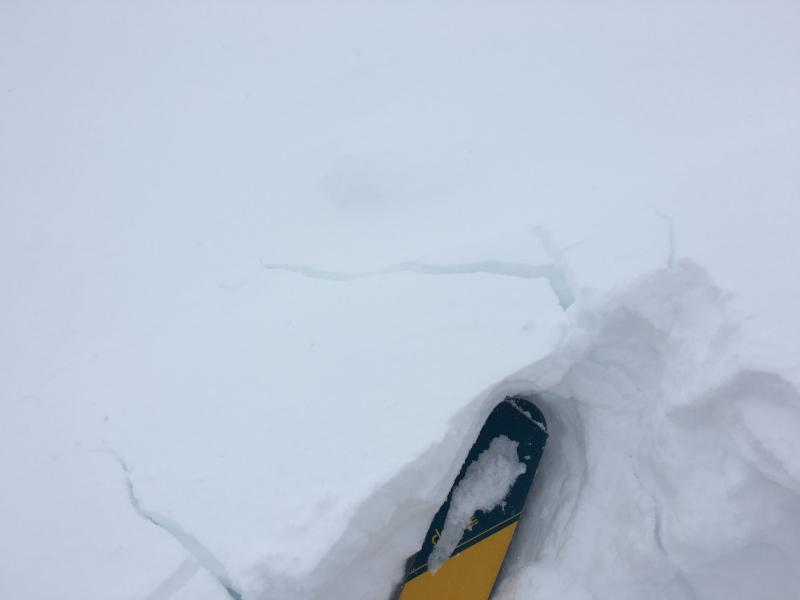
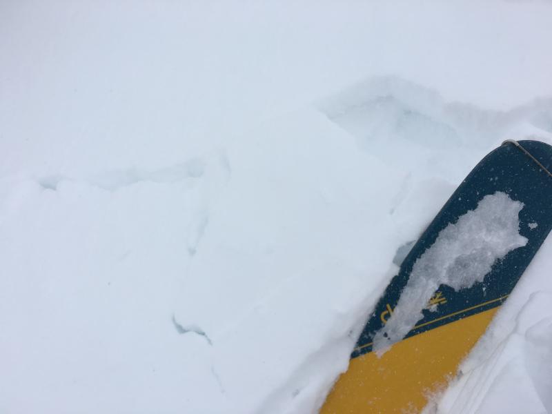
Pic. 1 & 2 Cracking in wind loaded terrain.

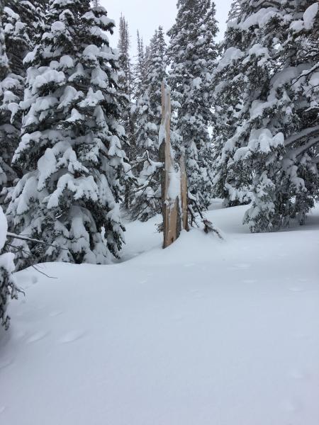
Pic. 3. More damage from the 2/21 wind event.

Today's Observed Danger Rating
Moderate
Tomorrows Estimated Danger Rating
Considerable