Observation Date
2/27/2017
Observer Name
Derek DeBruin
Region
Ogden » North Ogden Canyon » North Ogden Divide
Location Name or Route
North Ogden Divide, South Side
Weather
Sky
Obscured
Precipitation
Heavy Snowfall
Wind Direction
West
Wind Speed
Moderate
Weather Comments
This latest system definitely delivered. There was 5 or 6" of fresh snow at the Ogden Divide trailhead (6200') at 6:00am and it wasn't done yet. When I left the car the snow was coming down heavily, probably about S4, tapering down to S1 or S2 by the time I was back at the car around 0800. The divide picked up at least 3 more inches while I was out.
Temps were upper 20s F. Winds were generally westerly and consistently in the moderate range, but local topography allowed for gusts to strong from across almost the entire the north half of the compass, from W to NE.
Snow Characteristics
New Snow Depth
9"
New Snow Density
Low
Snow Surface Conditions
Powder
Dense Loose
Wind Crust
Rain-Rime Crust
Snow Characteristics Comments
I went to the Divide this morning anticipating some interesting snow conditions and was not disappointed. There was pretty decent spatial variability in the snowpack.
Protected locations (N facing gully, lower elevation, trees) featured light, fluffy powder from boot-top to knee deep. Exposed locations had a variety of wind effects: scouring (sometimes to bare ice) on the windward side, waist-high cornices on the ridges, and 1F wind slab formation on the windward side. Locations in between featured 3 to 12" of dense powder or soft slab atop an ice crust featuring with a thin layer of facets sandwiched between the ice and the powder/soft slab.
A little bit of everything, but careful avoidance of the ice and wind slabs featured great riding.
Red Flags
Red Flags
Heavy Snowfall
Wind Loading
Red Flags Comments
Leaving the car this morning was like stepping into a ping-pong ball in a dark room. Whiteout conditions with heavy snowfall and ample wind meant visibility was 50 feet or less at times, consistently between 100 to 200 feet, and maxed out at a quarter mile. Snow was accumulating rapidly and the wind was doing a good job keeping up and blowing it all over the place.
Technically, much of the Divide is at low elevation or the lower end of mid elevation, but on days when wind is a concern, I feel that it behaves similarly to mid or upper elevation terrain as it is just as exposed as much higher terrain on neighboring peaks.
Avalanche Problem #1
Problem
Wind Drifted Snow
Trend
Increasing Danger
Problem #1 Comments
I witnessed a minor spontaneous release below a cornice today, and wind slabs on lee features were at least 1F hardness (though I did not venture far onto them to investigate further). Given the ice layer and facets topped with low density snow for the wind slabs to rest upon, I anticipate wind slab avalanches today with the continuing snow and wind.
Avalanche Problem #2
Problem
New Snow
Trend
Same
Problem #2 Comments
Close on the heels of wind slab is soft slab/storm slab, also owing to the continued precipitation. The snow isn't particularly dense, but there was plenty of it already by 0600 and that's supposed to continue into tomorrow.
Comments
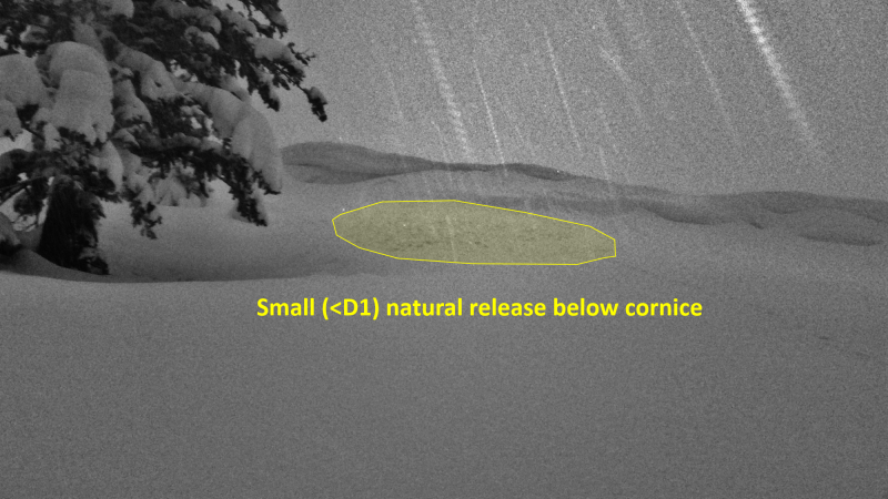
Small natural release on the lee side below a cornice at low elevation.
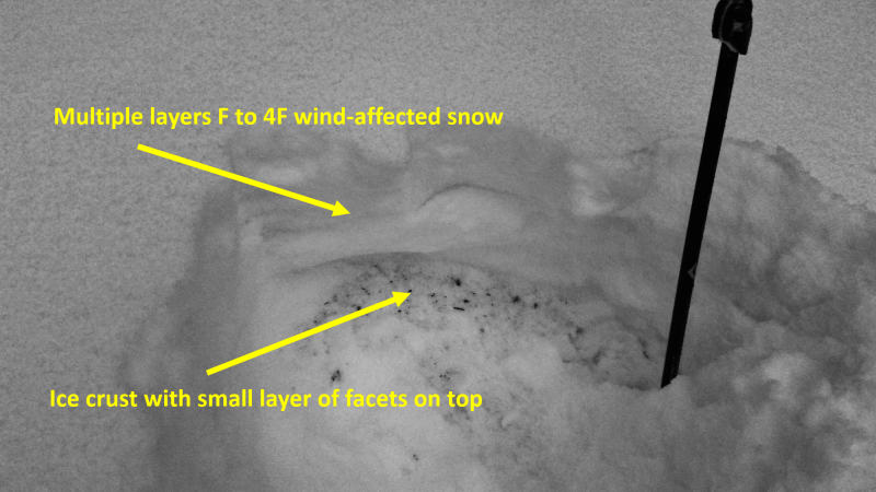
The upper portion of the snowpack, a variety of F to 4F wind-affected layers atop a thin layer of facets with an ice crust below. Skinning was interesting trying to push down 12" of dense powder to then scribe on an ice layer.
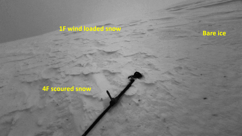
Approaching a north-facing ridge around 7300', with wind scouring, bare ice, and the backside of a cornice/wind slab all visible.
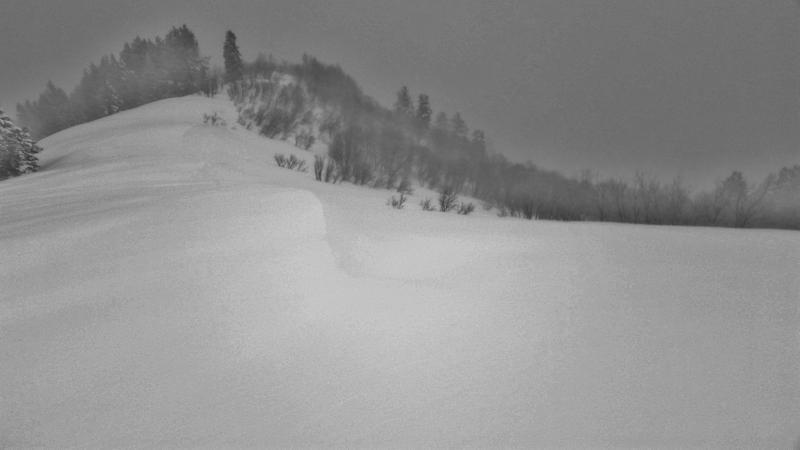
Small cornices near 7300 feet.
Today's Observed Danger Rating
Considerable
Tomorrows Estimated Danger Rating
Considerable