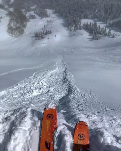
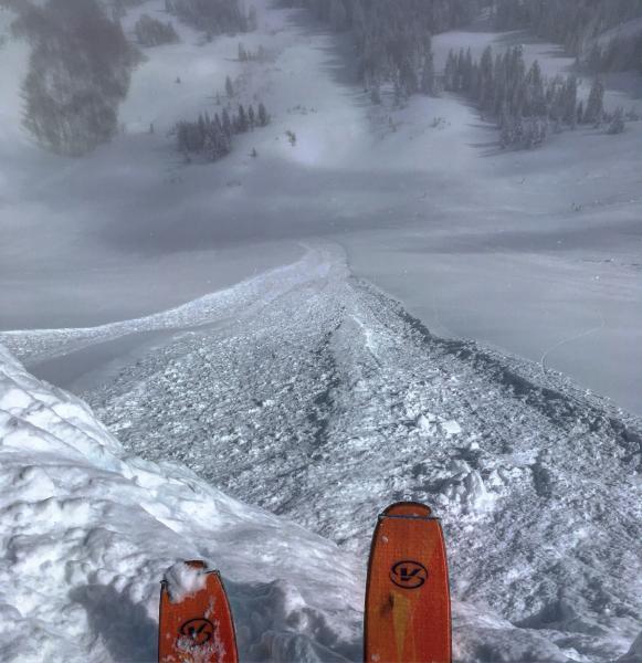
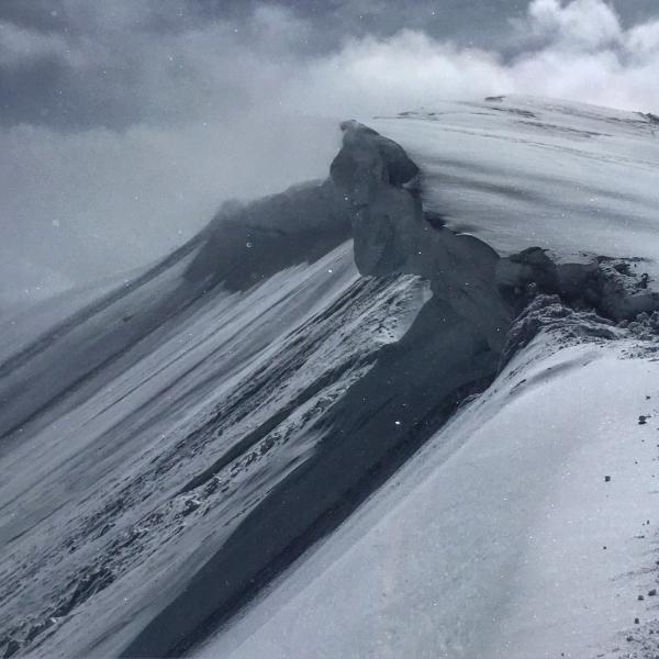
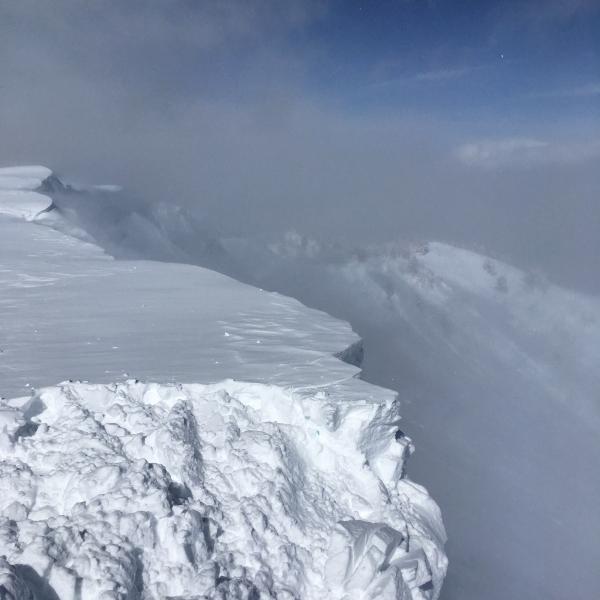
Made one more trip back to the Monitors today, wanted to get a better look at what happened during the storm and didn't have any visibility yesterday. The density inversion from yesterday was a thing of the past in the terrain covered today, yesterday I was getting continuous cracking on this layering and also set off a soft slab avalanche on the density inversion, today I had no cracking or any real sighs of instability in the new snow. The only instability of the day was long and fast running sluffs in the steeper terrain of West Monitor, these sluffs would entrain quite a bit of snow and run down to the flatter terrain at the bottom, easily managed with ski cuts and cornice drops. As the day progressed the snow settled out and these sluffs seemed less active. The S facing stayed good through out the day and still should be light and dry in the AM. I'm thinking the only thing that can throw a monkey wrench into the snow quality and stability is the wind, there's a ton of light density snow on all aspects that is available for transport if the wind picks up tonight. There was some wind transport on the high ridge lines and that's something that should be taken into account before diving into steep open wind loaded terrain. And once again some of the cornices are massive and should be given plenty of respect.
Photos: Long running sluffs in West Monitor, Huge overhanging cornice, wind transport on the high ridge line.
Moderate in the terrain covered today not so sure about LCC with more snow, and probably moderate tomorrow unless the wind comes into play.


