Observation Date
2/24/2017
Observer Name
Dave Garcia
Region
Moab
Location Name or Route
Laurel Highway > Gold Miner's
Comments
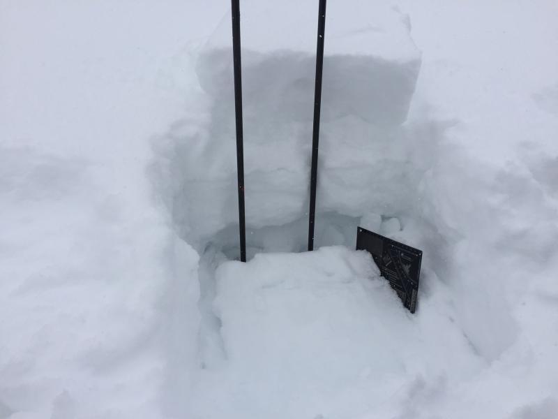
Pit Details: Aspect: 334 (NNW), Slope Angle 27 degrees, Elevation 11,000 Pit Depth: 84cm. Above in the red flags sections I choose "poor snowpack structure." I chose this pit location because I expected to possibly find some weak layers here. In the photos below you can see the interfaces between the different layers of snow. There is faceted snow in each of these interfaces. At 34cm down there is a 1F hard slab about 27cm thick. This is sitting on top of a facet/crust/facet interface seen at the bottom of the pit. Lots of facets at the bottom, so I expected these layers to fail under compression. Two side by side compression tests produced no results. (CTN) I was originally going to avoid the larger, steeper part of this slope adjacent to the pit, but I decided to ski it based on these pit results. Skied slope angles in the low 30's adjacent to this pit. It should also be noted that even though this slope is north facing, it was not wind loaded today.
Got an easy hand shear on a west facing slope in Laurel Meadows. A 1F slab sitting on a very thin layer of facets on a firm bed surface. The slab is seen in the photo behind the ski poles sitting on top of the new snow surface. Also got moderate hand shears in Upper Julie's (W) and Prelude (NW) on this same layer. This layer did not react to a large group of skiers (6 to 8) that skied the funnel today.
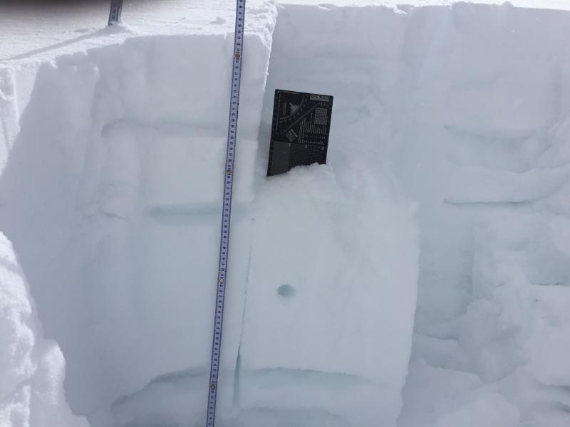
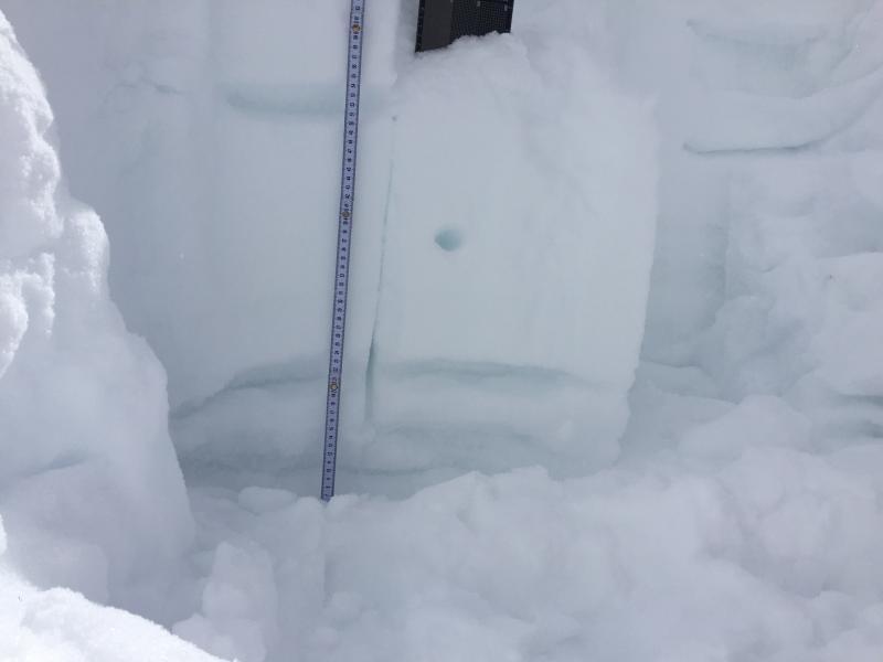
A couple photos of today's snow pit. The layers of containing facets are outlined. The second photo is a better view of the bottom layers that I was concerned about. The 1F slab is seen below the crystal card.
Today's Observed Danger Rating
Moderate
Tomorrows Estimated Danger Rating
Moderate
Coordinates


