Planned Website Outage: The UAC website will be down for maintenance on June 17 from 2:00 - 7:00 PM MT.

Observation: Days Fork

Observation Date
2/22/2017
Observer Name
Tyler Falk
Region
Salt Lake » Big Cottonwood Canyon » Days Fork
Location Name or Route
Days Fork
Weather
Sky
Obscured
Precipitation
Light Snowfall
Wind Direction
West
Wind Speed
Light
Weather Comments
Cold tempatures droping through the afternoon with snowfall intensity from S1 to S2 by 4 pm. Light winds on 10k ridgelines with no transport noticed.
Snow Characteristics
New Snow Depth
13"
New Snow Density
Medium
Snow Surface Conditions
Powder
Snow Characteristics Comments

New storm snow around 33cm in upper LCC. Sluffs noticed in steeper terrain. South aspects at 9200' had 55cm of snow from the last two storms on top of our 35 cm deep pencil hard melt freeze crust layer which developed from our stretch of high pressure last week. Under that were wet grains. Not much energy from ECT's in that location other than showing a density change in the storm snow. Height of snow around 235cm. When you get to 10k on North aspects the wet grains are much less noticeable in the pack under the two most recent storms.

Red Flags
Red Flags
Recent Avalanches
Heavy Snowfall
Red Flags Comments
Noticed a few crowns just west of the Hallway in Cardiff that might have released early on 2/22 or the night of 2/21. R1/D1 Other recent avalanches have been observed around Brighton recently. Around 2.25" of H2o from the storm as of 2/23 am.

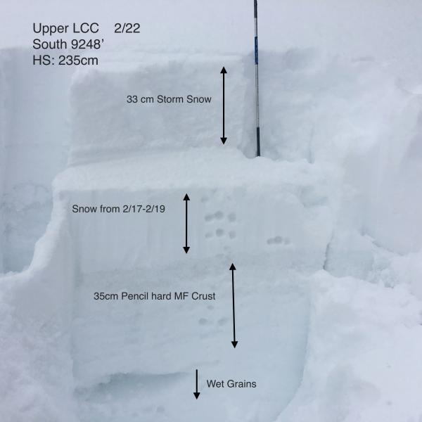
Pic.1 Quick pit on S @9200'

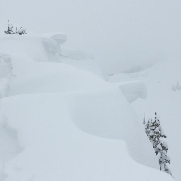
Pic 2. Large Cornices top of Days

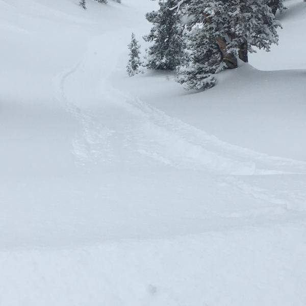
Pic 3. Loose snow sluffing

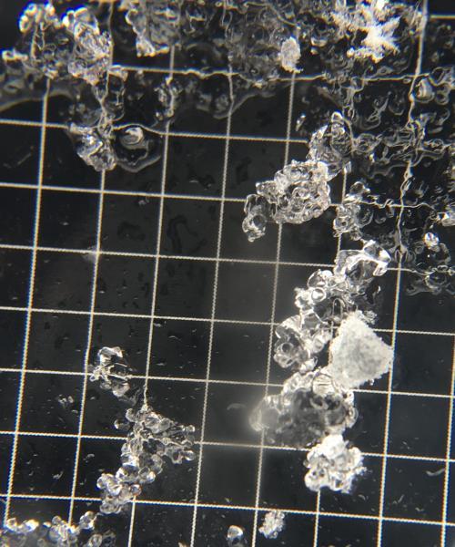
Pic 4. Wet grains with saturated graupel

Today's Observed Danger Rating
Considerable
Tomorrows Estimated Danger Rating
Considerable