
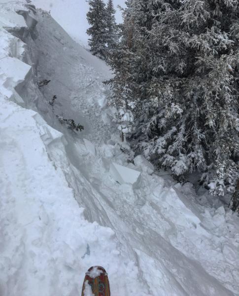
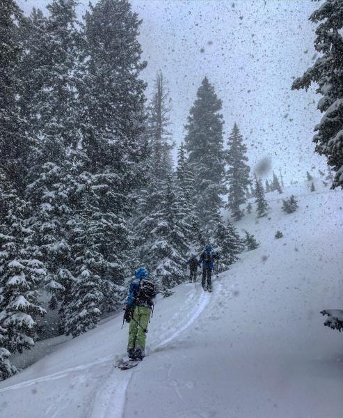
Went up to the PC Ridgeline today, wanted to start at a fairly high elevation and stay at that high elevation for the day. The snow rain line was hovering around 7100ft all day, and the snow was damp up past 8000ft. We did trigger one avalanche which was a wind slab on buried facets that I put on the Avy page. I think most of the terrain we covered was lacking the combination of buried facets with enough of a load to be a concern, but we did manage to find a protected, shady north facing slope with a wind slab creating enough of a load to avalanche with the weight of a person. Most of the other slopes we skied either had a melt freeze crust under them E,S and W facing, or damp snow at lower elevations. There was a good amount of sluffing on the steeper slopes with the melt freeze crust underlying them and the large overhanging cornices were also still not completely frozen and would break back further than expected.
Photos: Cornices breaking back further than expected, High PI rates in the afternoon.
I'm still thinking most of the buried facets are at higher elevation, maybe 9400ft and up but there might be some outlying pockets under that elevation. The sun might be the main player tomorrow if it comes out along with the buried weak layer at higher elevations.


